Bronx River Bascules

The three Bronx River Bascules as they were originally constructed, 1909 (Copyright: Bronx Historical Society)
The current bridges, with the tower and one span removed

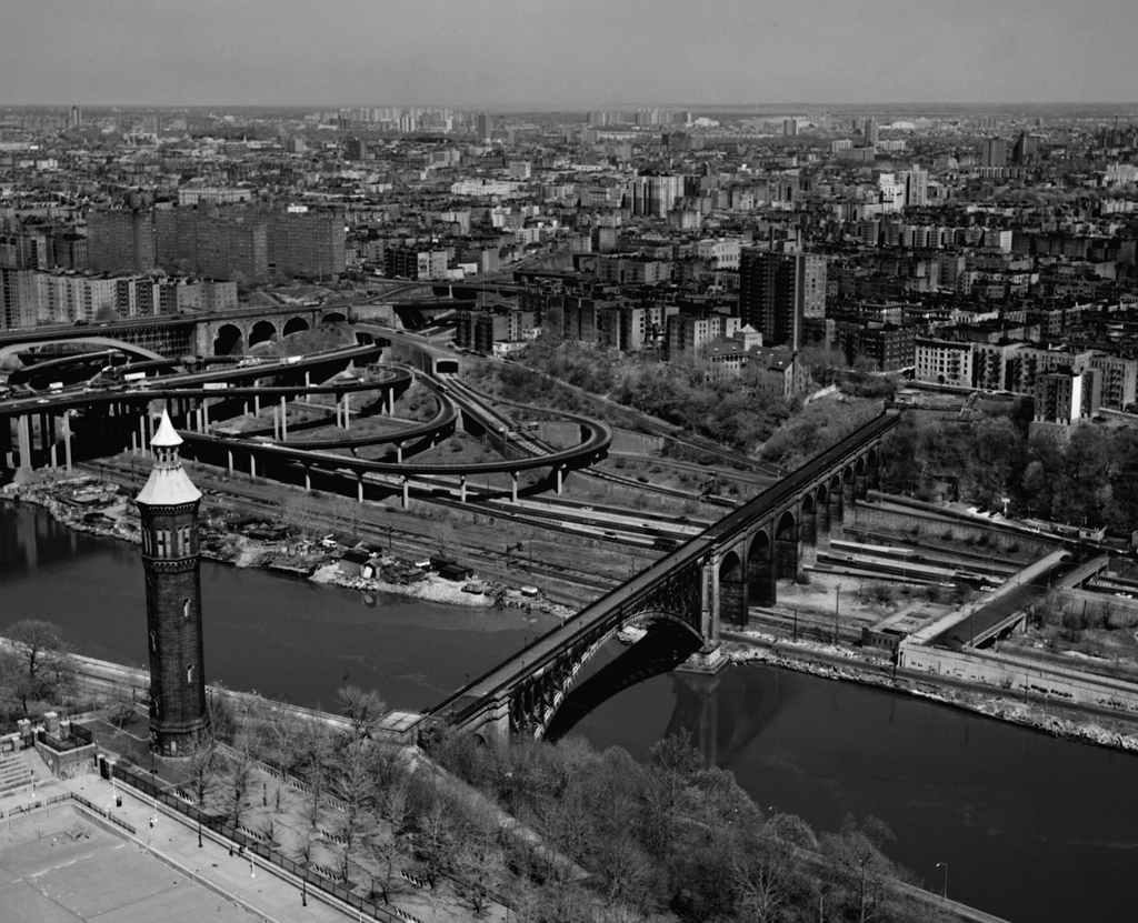
Location: Bronx River north of the Westchester Avenue Bridge, Bronx, NY [satellite map]
Carries: 3 railroad tracks (Amtrak and CSX)
Design: Scherzer Rolling Lift (bascule)
Date opened: summer 1908

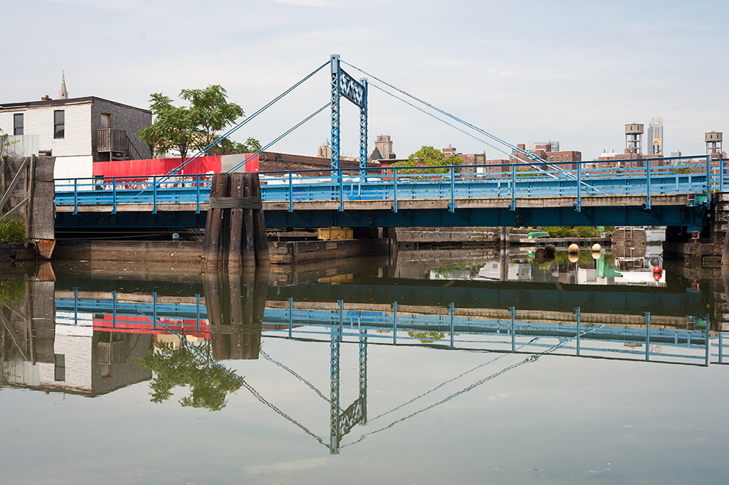
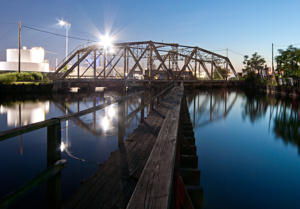
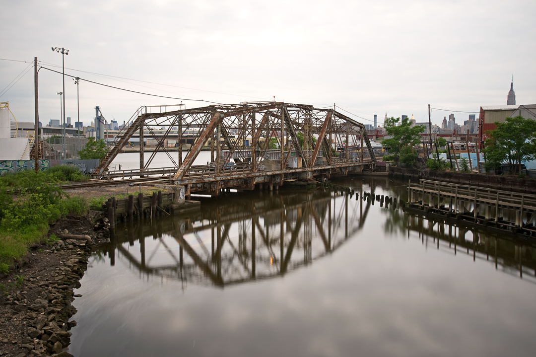
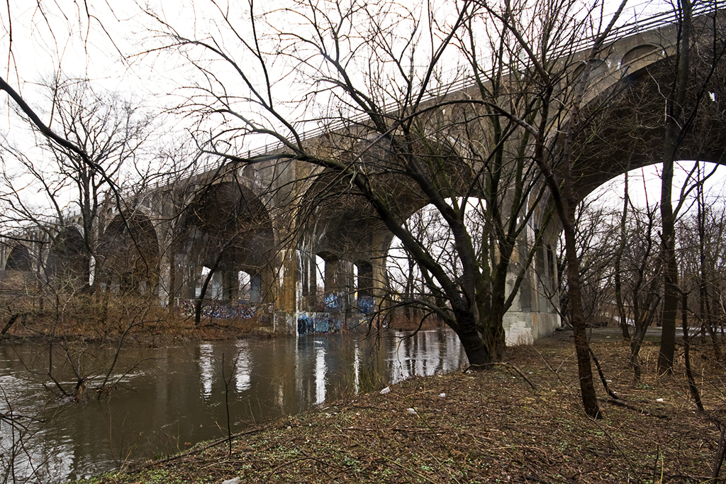
The name “Bronx River Bascules” is not an official one. In fact, these bridges do not seem to have ever been given a proper name. The New York, New Haven & Hartford Railroad, which constructed them, referred to them simply as “bridge number 3.40” [1]. They cross the Bronx River just north of Westchester Avenue and were put into service in the summer of 1908.

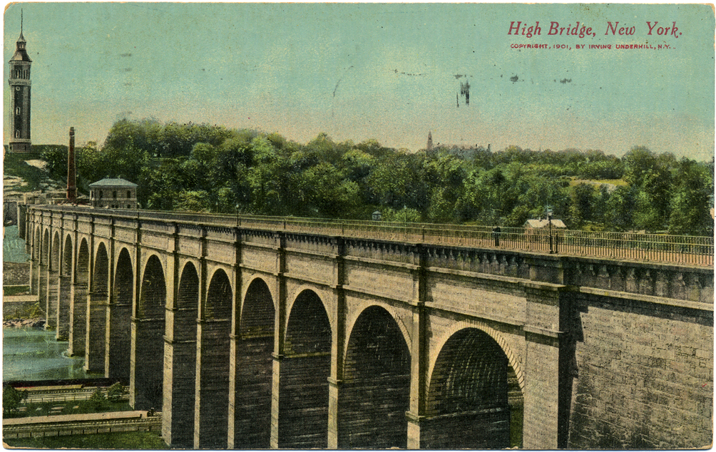
The Harlem River Branch

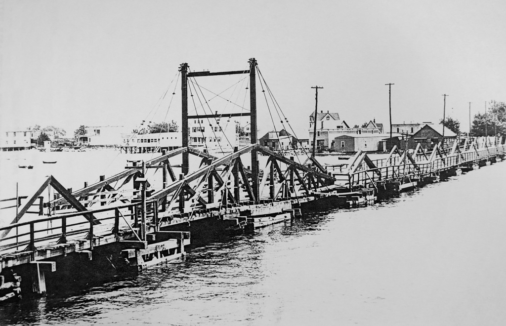
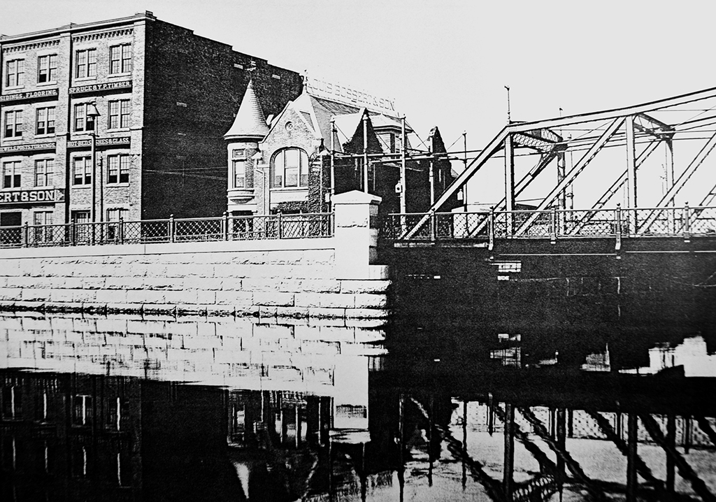
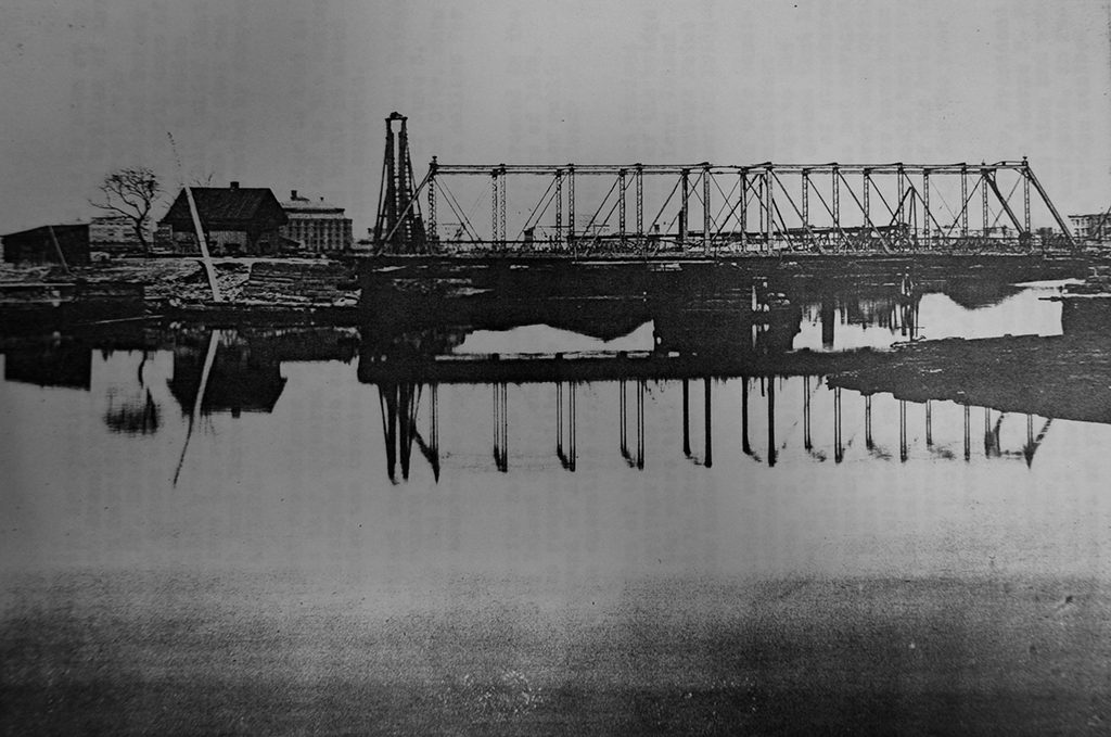
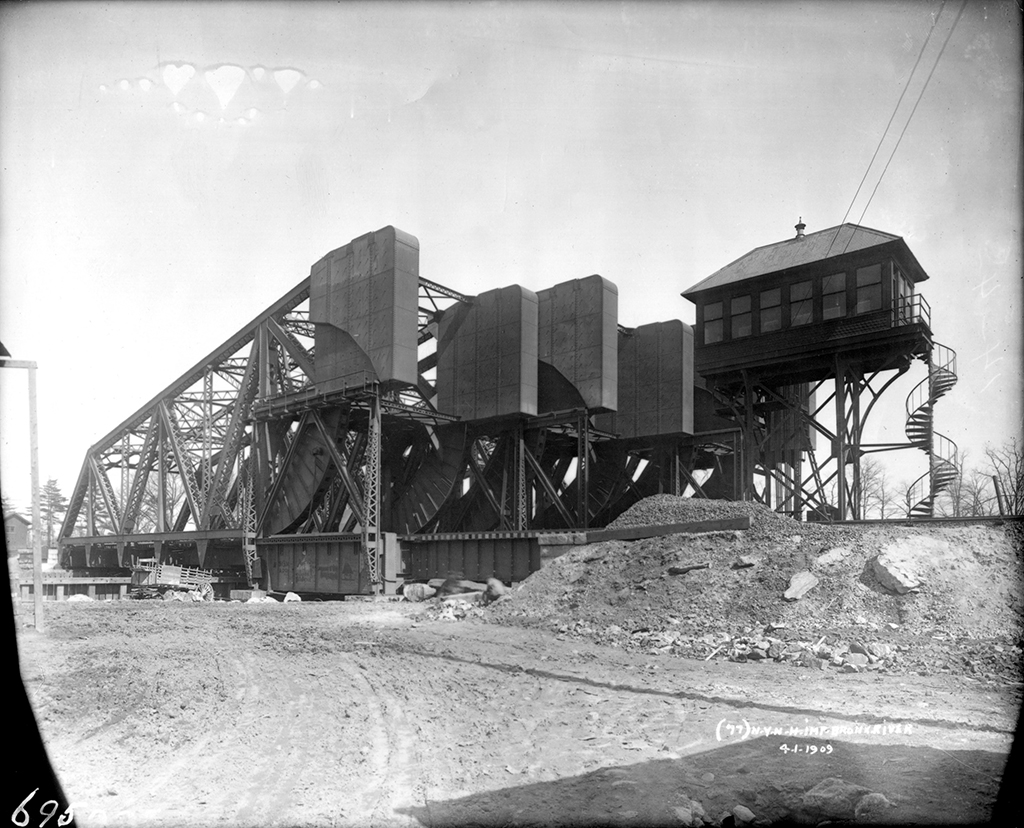
The New York, New Haven & Hartford Railroad began running passenger and freight service on their Harlem River Branch in 1868. Two jackknife drawbridges carried trains over the Bronx River at the present site until 1893, when they were replaced by a four-track swing bridge. In 1907, the swing was removed and two temporary jackknife drawbridges were put in place. Between 1908 and 1910 the Harlem River Branch was completely rebuilt to carry six tracks and run on electricity. New stations were also built along the route. The closest was the Westchester Avenue station, which stands in ruins today to the south of the bridges, local passenger service having been discontinued in the 1930s.

Diagram showing original configuration (Source: The Engineering Record)

Construction

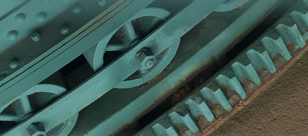
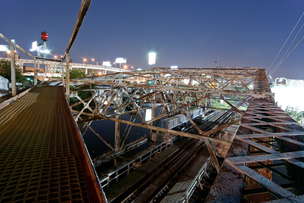
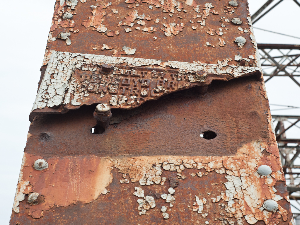
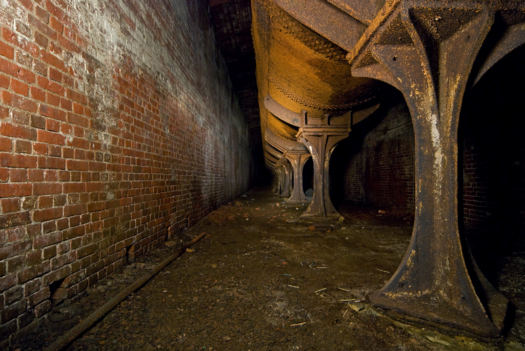
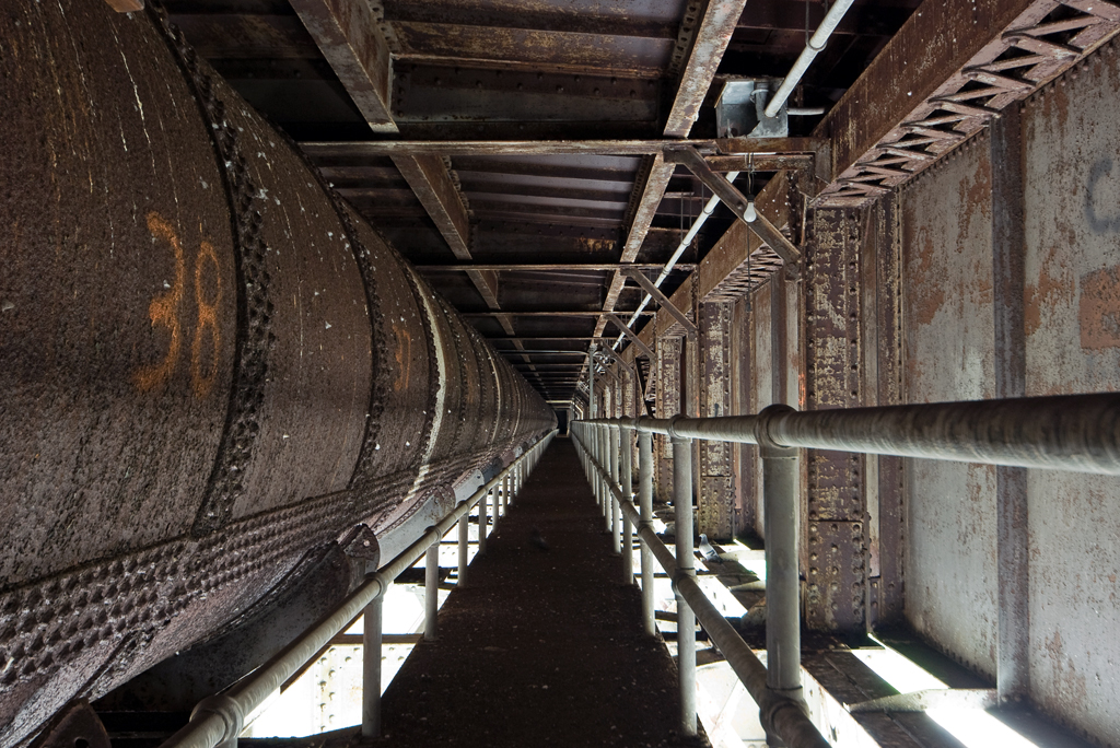
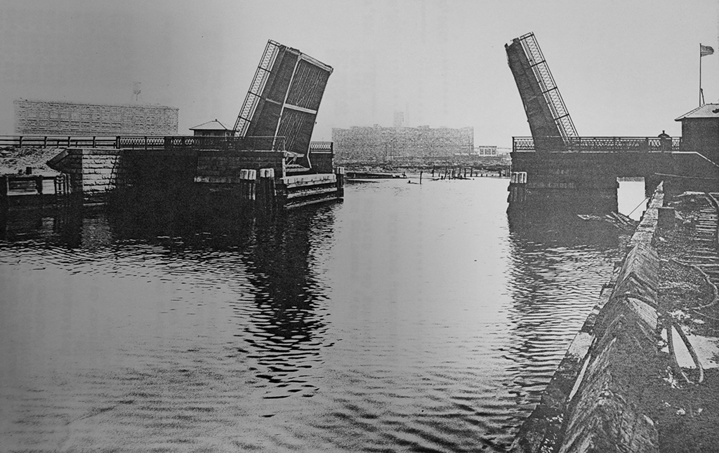
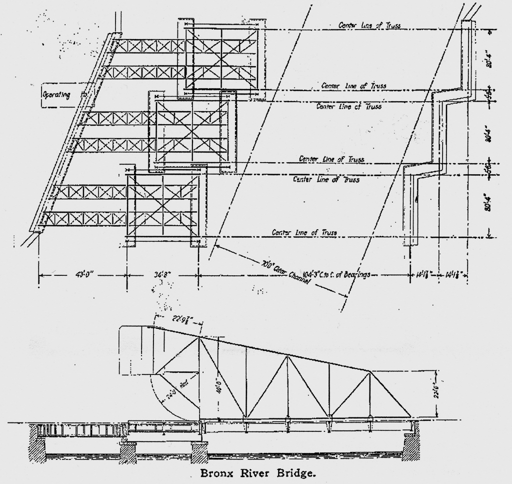
The bridge superstructure, as originally built by the Pennsylvania Steel Company, was made up of three parallel two-track spans with separate piers on each end, staggered to accommodate the curve of the Bronx River (see diagram). Since the channel is so narrow (about 100 feet wide), the type of bridge chosen was a bascule, which did not obstruct the waterway as the swing bridge had. The particular type of bascule is the Scherzer Rolling Lift, invented by William Scherzer in Chicago; they operate by rolling back into the open position, rather than turning on a fixed axle as in other bascule designs. Since the Harlem River Branch was being electrified, tall towers were put up to carry high voltage wires above the bridges while in the open possition. Each leaf of the bridge was powered by two Westinghouse 25 horsepower, 550 volt direct current motors. All three leaves could be raised simultaneously in about a minute, and as a backup could be opened manually with a chain, though it was never necessary to do so.
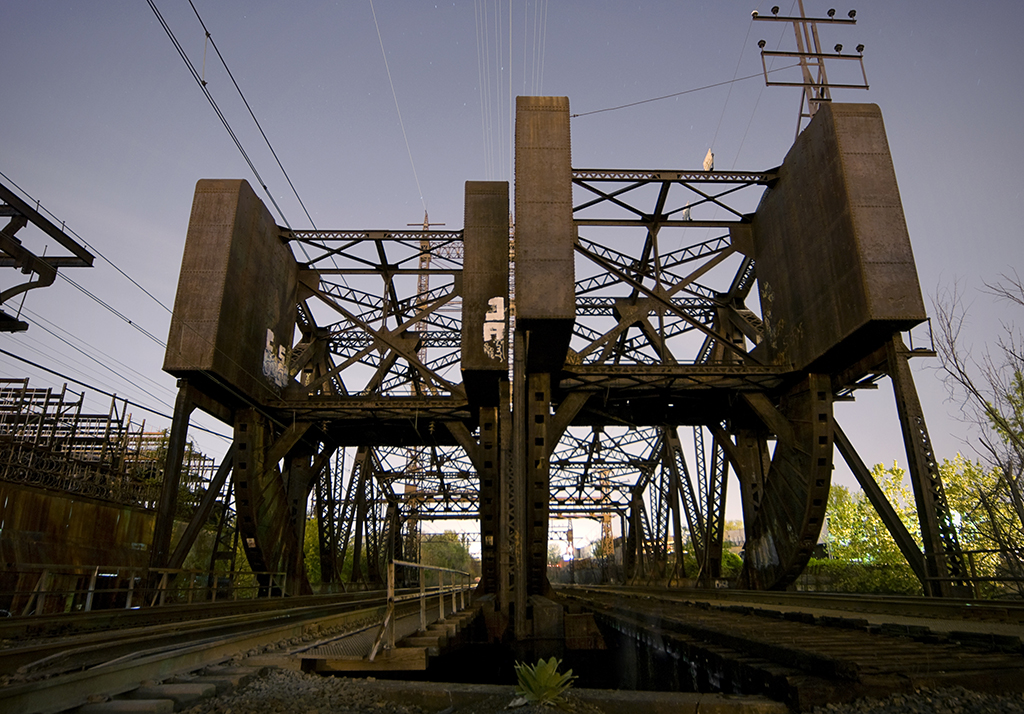
Growth & Decline

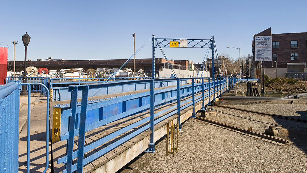
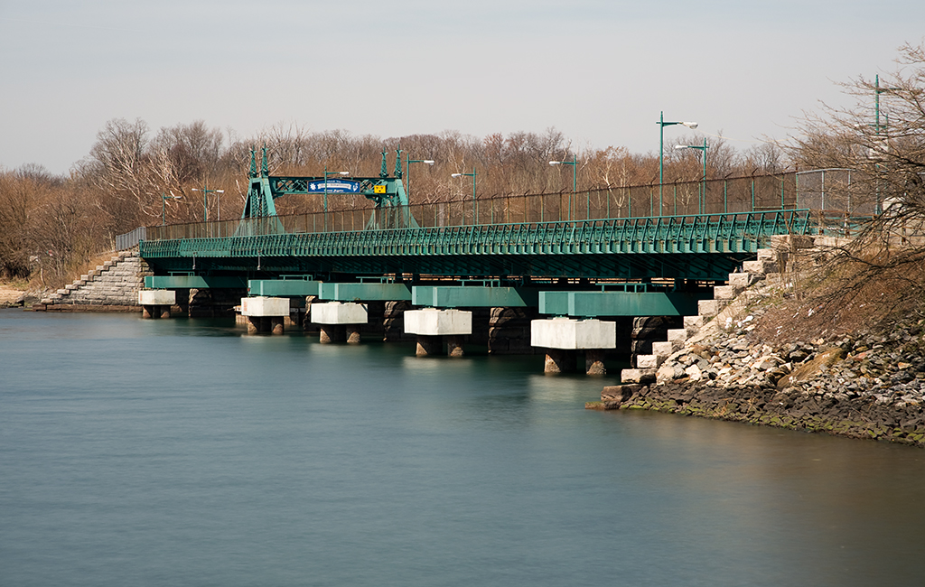
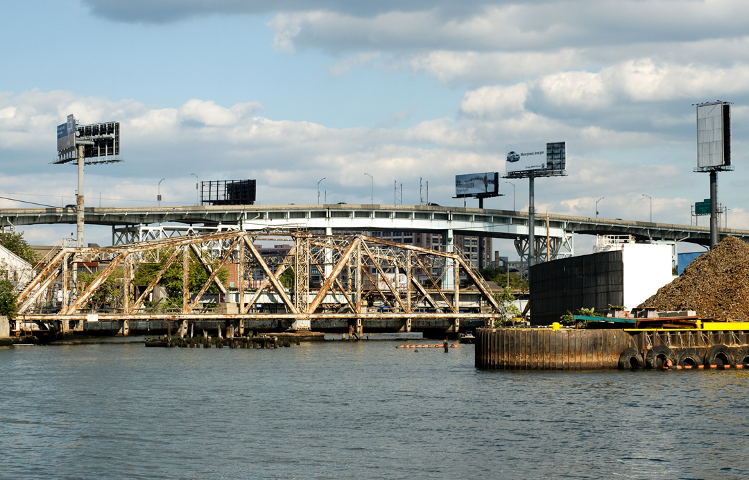
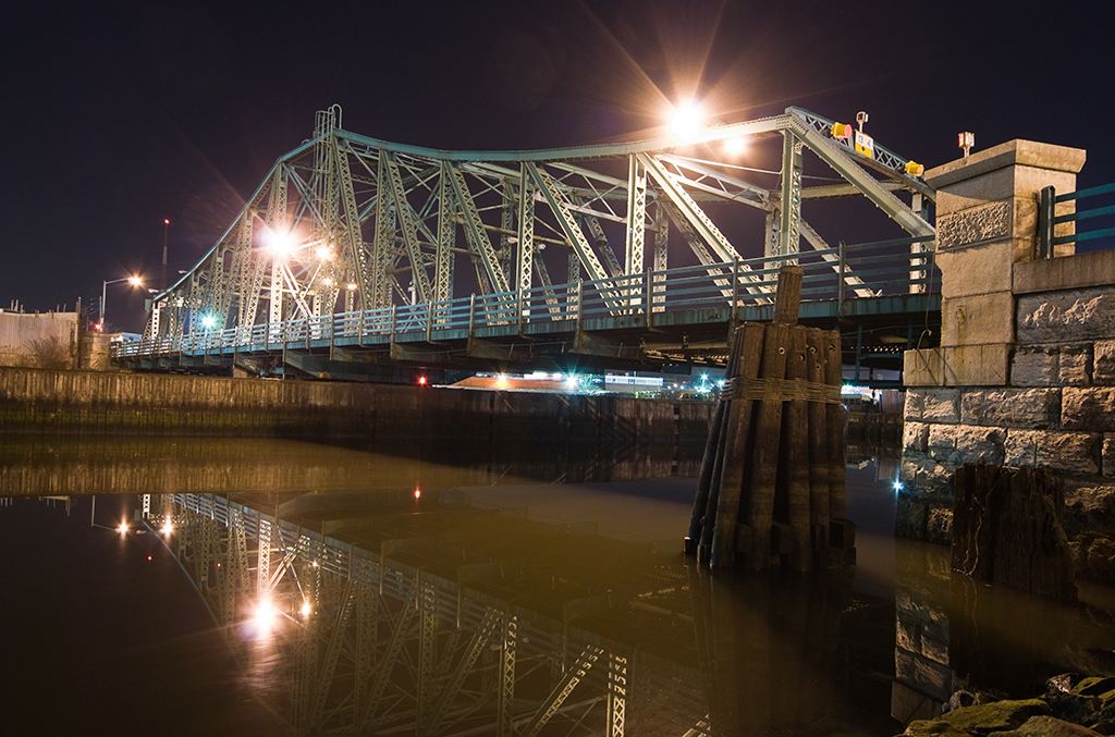
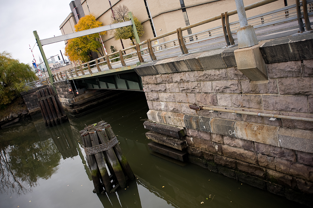
About 200 trains passed over the bridges daily during their first years of operation; on average they opened 5 times a day during the winter and 12 times a day throughout the rest of the year [2]. With the opening of the Hell Gate Bridge by the New York Connecting Railroad in 1917, the Harlem River Branch became part of a much larger through route accommodating trains traveling from Penn Station to Boston. Over the years rail service declined, as did use of the Bronx River by boats requiring bridge lifts for passage. At some point, the tower containing the operating machinery and one two-track span were removed. The bridges now have only three tracks: one used by CSX for freight and two carrying Amtrak passenger trains on the Northeast Corridor Line.

012BronxBascules03

[ continue to references ]

Carroll Street Bridge

Carroll Street Bridge and the Gowanus Canal

Crosses: Gowanus Canal
Connects: Carroll Gardens and Park Slope, Brooklyn, NY [satellite map]
Carries: 1 vehicular lane, 2 sidewalks
Design: retractile
Date opened: 1889

The Carroll Street Bridge is a retractile drawbridge that crosses the Gowanus Canal in the borough of Brooklyn. It is notable as the oldest surviving retractile bridge in the United States, with only three others still in existence: two non-operational draws in Boston, and one carrying Borden Avenue over Dutch Kills in the borough of Queens.

004carrollst01
Retractile span with wooden deck

Planning and Construction

The bridge was built between 1888-1889 by the New Jersey Steel & Iron Company. It replaced a wooden swing bridge that had become so rotten over the years that city engineers were forced to close it in early 1887 to everything but pedestrian traffic, fearing it would collapse under anything heavier. The Brooklyn Common Council passed a resolution in July 1888 ordering that $1200 be allocated for the repair of the bridge. Brooklyn Mayor Alfred Chapin, following the advice of city engineers who felt that repairs would be useless on such a deteriorated structure, vetoed the resolution and instituted a tax levy that would raise $40,000 to pay for a replacement structure.

Plans for the new bridge were developed soon after. George Ingram and Robert Van Buren, engineers with the Department of City Works preferred a retractile bridge to replace the old swing span, as did local property owners. In September 1888 the old bridge was removed, and a public auction was announced for the sale of the superstructure. Construction of the new one was begun at the end of the year. It opened in September the following year, completed at a cost of $29,600.

Rehabilitation and Landmarking

By the 1980s, the bridge had fallen victim to the city’s deferred maintenance program. The Department of Transportation closed the bridge in 1985 after an inspection revealed multiple holes in the road deck, seriously corroded steel, and a broken operating mechanism. After a $1.5 million overhaul by city workers, the bridge was able to reopen to traffic just in time for the 100th anniversary of its initial opening in 1989.

horn fixed to bridge house; sign warning of five dollar penalty
Horn fixed to bridge house; Sign warning of five dollar penalty

As a retractile draw, the bridge opens by physically sliding out of the navigation channel on a set of three steel rails, pulled by an electrically operated pulley system. The moving portion of the bridge is a 107-foot long trapezoidal deck, supported in the middle by an iron post-and-truss frame that gives the superstructure the appearance of a suspension bridge. The operating controls for the bridge are located in a polygonal brick house on the west side of the site. The house was built during the bridge’s overhaul project of bricks salvaged from the demolition of the old operating house. One of the more interesting features of the bridge, a sign threatening a five dollar fine for anyone driving over the bridge faster than a walker’s pace, was also added during the overhaul.

The unique style of the this bridge gained it landmark status in 1987, with the Landmarks Preservation Commission citing its “rare and unusual” qualities. This designation is meant to preserve the historical nature of the bridge from being altered without the Commission’s approval.

– – – – – –

References

1888, July 22. A rotten bridge. Brooklyn Daily Eagle. Retrieved from: eagle.brooklynpubliclibrary.org

1888, September 10. Notice of sale of Carroll Street Bridge. Brooklyn Daily Eagle. Retrieved from: eagle.brooklynpubliclibrary.org

1889, September 26. Work on the Carroll Street Bridge completed. Brooklyn Daily Eagle. Retrieved from: eagle.brooklynpubliclibrary.org

1987. Carroll Street Bridge Over the Gowanus Canal, Borough of Brooklyn, built 1888-1889 … [report]. Landmarks Preservation Commission. New York: Landmarks Preservation Commission. Retrieved from: neighborhoodpreservationcenter.org

1989, May 21. Gray, Christopher. Getting a landmark in shape for its 100th birthday. New York Times, p. R12. Retrieved from: nytimes.com

1989, September 24. Pitt, David E. Two neighborhoods celebrate restoration of their bridge. New York Times, p. 40. Retrieved from: nytimes.com

1989, September 29. Bringing back the bridges. New York Times, p. A34. Retrieved from: nytimes.com

City Island Bridge

City Island Bridge
City Island Bridge

Crosses: Pelham Bay
Connects: Pelham Bay Park and City Island, Bronx, NY [satellite map]
Carries: 2 vehicular lanes, 1 fire lane, 2 pedestrian sidewalks
Design: (former) swing bridge, now fixed
Date opened: July 14, 1901
Postcard view: “New Bridge. City Island, N.Y.”

The City Island Bridge is a fixed bridge (formerly a swing) that connects City Island with Rodman’s Neck in Pelham Bay Park, in the eastern part of the borough of the Bronx.

City Island is a small island, just one and a half miles long by half a mile wide, off the coast of the Bronx mainland in Eastchester Bay. It is known locally as “The Seaport of the Bronx,” and is famous for its resemblance to New England fishing villages. City Island was first settled by the English in the second half of the 17th century after Thomas Pell’s purchase of over 9,000 acres of land from a local Native American tribe known as the Siwanoys. It was originally known as Minnewits or Minefords Island after either Peter Minuit, purchaser of Manhattan, or another local tribe. In 1761, the island was purchased by a businessman named Benjamin Palmer (the builder of Farmer’s Bridge), who hoped to establish the island as a rival city to New York. The American Revolution prevented his plans from coming to fruition, though the name he chose for the settlement, New City Island, stuck, surviving for about a hundred years before being shortened to the current City Island.

Need for a Bridge

On May 10, 1763, the first ferry was established between City Island and Rodman’s Neck. On April 3, 1775, the State Legislature passed an act authorizing Benjamin Palmer and Samuel Rodman, who owned the land closest to the island, to build a “free draw Bridge over the Narrows from Mineford’s Island to Rodman’s Neck” [1] within seven years of the passage of the act. It is apparent, however, that no action was taken. Another act was passed in 1804 to allow the construction of a bridge, but the initiative failed due to lack of financial support.

David Carll's wooden bridge, built circa 1873 (Source: Historical Facts in Connection with New York City Bridges)
David Carll’s wooden bridge, built circa 1873 (Source: Historical Facts in Connection with New York City Bridges)

First Crossing

Nothing further was done until April 30, 1864, when the City Island Bridge Company was incorporated to build a toll bridge to City Island. The company failed to build a bridge, however, and the State allowed the town of Pelham, of which City Island was a part of at the time, to acquire the title to the bridge company and permission to charge tolls in 1873. Around the same time, David Carll, a prominent shipbuilder with a large shipyard on City Island, purchased a decommissioned US warship named the North Carolina at a public auction. Carll used wood salvaged from the ship to build a number of smaller boats, and used the leftovers to build the first bridge connecting City Island with the mainland. That bridge (above), was built primarily of wood from the North Carolina, with some ironwork taken from the old Cole’s Bridge, the first bridge to cross the Harlem River. It was was widely reported at the time and for years afterwards (and occasionally even today) that the entire bridge was moved by scows to City Island when it was replaced by the first Third Avenue Bridge, but this appears to be incorrect.

A New Bridge

The town continued to charge tolls on the bridge until 1895, when that part of the Bronx was annexed by New York City. The bridge had become seriously deteriorated by then, with some newspaper accounts telling of residents who had become too afraid to cross it. Plans were already underway for a replacement, however, with the state passing laws in 1894 and 1896 authorizing the construction of a new bridge. Contracts for the construction of the new bridge were signed by Mayor William Strong in 1897, reportedly two hours before the end of his term of office. Construction on the new bridge began on January 19, 1899.

Fixed position and reinforced piers

The City Island Bridge was built as a swing bridge with a 180-foot-long swing span and five 80-foot-long fixed approach spans. The structure was built atop six masonry piers sunk 40 feet below the surface of the water to rock, and faced mostly with blue gray limestone. The pier sinking and structure construction were performed by the John F. O’Rourke contracting company of New York. The swing span, built by the King Bridge Company, is of a through truss design, with a rectangular central tower topped with ornamental finials and concave chords on each side supporting the deck. It was completed in 1901 at a cost of $250,000. The bridge was informally opened to pedestrians by Deputy Commissioner of Bridges Matthew Moore on July 4, 1901 as a favor to City Island residents looking to celebrate the nation’s 225th Independence Day, fifty of whom attended the opening. Two weeks later, on July 14, a bridge watchman named Sprout officially opened the bridge to horse carriage traffic by cutting away the old manila ropes that had hung across each end of the roadway.

Monorail

In 1910 a monorail line, the first in the western hemisphere, was established by the City Island Monorail Company between the Bartow Station of the New York, New Haven, and Hartford Railroad and a station at the eastern approach to the City Island Bridge, with plans to build an extension over the bridge to a station on the island itself. The line was a failure, however, and the system was dismantled on March 16, 1914 to make way for a standard two-rail trolley line.

Repairs and Plans for Replacement

By the 1970’s, like so many other New York City bridges, the City Island Bridge began to show its age. Divers for the city inspecting the bridge’s substructure found cracks and faults in the limestone piers supporting the bridge. A major rehabilitation project began in 1977, extending the life of the bridge by several decades.

Turntable
Turntable

The bridge has continued to deteriorate since then, however, and the city now plans to replace it entirely. The new bridge will be of a cable-stayed design, with a 150-foot concrete tower supporting the bridge deck via a system of suspension cables. The Department of Transportation has compared the new design to the mast of a sailboat, fitting the island’s image of a nautical town. Some City Island residents disagree; one member of the City Island Historical Society called the design “a monstrosity” [2] . Work was originally set to begin in 2006, but has been pushed back to 2011 due to budgetary concerns.

[ continue to references ]

Dutch Kills Swing Bridge

Dutch Kills Swing Bridge
Dutch Kills Swing Bridge, 2008

Crosses: Dutch Kills
Location: Long Island City, Queens [satellite map]
Carries: 1 freight track (Long Island Railroad)
Design: (former) swing bridge, now fixed into place
Date opened: 1893

The Dutch Kills Swing Bridge was built by the Long Island Railroad as part of its Montauk Branch in 1893. Located in the southern part of Long Island City, it crosses the Dutch Kills, a tributary of Newtown Creek.

Dutch Kills and the Growth of Long Island City

As discussed in the history of the Hunters Point Avenue Bridge, the land surrounding Dutch Kills (“kills” is “creek” in Dutch) was originally marshland. The area’s first European settlement was in 1642 by Richard Bruntall, who owned 100 acres of land on the eastern side of Dutch Kills where it meets Newtown Creek [1]. To the west lay an area purchased by minister Dominie Everardus Bogardus for use by the Dutch Reformed Church called Dominie’s Hoek (Hook). In 1664 it became part of the Town of Newtown and later was given to British sea captain George Hunter. It was renamed Hunters Point in 1825. Both Hunters Point and the area surrounding Dutch Kills remained quiet farmland and estates until the 1840s, when industry began to grow on Newtown Creek. The railroads arrived in the 1850s, and industrialization continued. In 1870, Astoria, Ravenswood, and Steinway incorporated with Hunters Point to form Long Island City. Both Newtown Creek and Dutch Kills were used heavily by factories and other businesses located on their banks necessitating the construction of a number of movable bridges.

The Railroads and Hunters Point

The Hunters Point area of Long Island City has a long history as a transportation hub. As New York City expanded, so did the need for commuting. Before bridges and tunnels connected Manhattan to Brooklyn, Queens, and New Jersey, passengers relied on ferries to cross the East and Hudson Rivers, often directly linking to railroads continuing to points further afield. In 1854, the Hunters Point Terminal was opened by the Flushing Railroad. It was the first railroad to operate in Long Island other than the Long Island Railroad (founded in 1834) and ran from the Hunters Point waterfront where Newtown Creek empties into the East River to Flushing, Queens. The ferry followed soon after the railroad: from 1858 until its closure in 1925, the Thirty-fourth Street Ferry crossed the East River between Manhattan’s east side and the Hunters Point Terminal. The Flushing Railroad was reorganized in 1859 as the New York and Flushing Railroad. Hunters Point continued to grow, and by 1873 two additional railroads had moved in: the Flushing, North Shore and Central Railroad and the South Side Railroad both constructed terminals. By 1884 all the railroads had been merged into the Long Island Railroad. Passengers could travel via the Lower Montauk Branch across the Dutch Kills to Penny Bridge (which provided access to Calvary Cemetery) and points further east.

Dutch Kills Swing Bridge, 2011

C.C. Schneider’s Bridges

The first rail crossing of the Dutch Kills opened in 1854 along with the railroad; no information about it was found. The expanding Long Island Railroad replaced it with a two-track swing bridge in 1880. The bridge was designed by the German-born American civil engineer Charles Conrad (C.C.) Schneider. Schneider later wrote that the span opened, but with difficulty:

It occurred to the writer that a bridge which is to be used as a fixed span, but must be designed so it can be opened, should meet, in the first place, the conditions most desirable in a permanent structure, viz., when closed it should be practically a fixed span, resting on substantial supports, which, however, could be removed if it should become necessary to open the bridge. This, to the writer’s knowledge, was the first swing bridge where wedges were used as supports at the center. The arrangements for operating the wedges was very crude. [2]

The wedge design for swing bridges never caught on, but Schneider continued to build bigger, more well-known bridges. In 1882, the Michigan Central Railroad asked him to submit a proposal for a bridge across the Niagara Gorge; his design for a two-track cantilever bridge was accepted and built the following year and came to be known as the Niagara Cantilever Bridge (it was replaced in 1924-5 by the Michigan Central Railway Bridge, of an arch design, which is abandoned but still standing). Also in 1883, he started his own civil engineering firm in New York City. In 1885 his design for an arch bridge across the Harlem River north of High Bridge was selected and opened in 1889 as the Washington Bridge. He partnered with the Pencoyd Iron Works in 1886. The company, founded in 1857 and located along the Schuylkill River in Pennsylvania, had started out making wrought iron but by that time had become a major supplier of steel for bridge building. Schneider, using Pencoyd steel, designed and built bridges for various railroads, among them the Pennsylvania and the Chesapeake and Ohio. He was an early engineer on an East River bridge proposed by the Long Island Railroad in 1893. Construction on that bridge started in 1895 but quickly ended due to a lack of funds–later the Blackwell’s Island Bridge was built (now known as the Queensboro Bridge) across the same stretch of the East River.

Dutch Kills Swing Bridge, 2008

Current Bridge

While not nearly as high-profile as the Blackwell’s Island Bridge, Schneider designed another bridge in 1893: a replacement for his 1880 span across the Dutch Kills. The channel for boats was widened and demand to use the waterway was up, so the new swing bridge was larger, longer, and carried three (rather than two) railroad tracks. It was of a more modern swing design and, while providing little clearance above the water, it was capable of opening far faster than its predecessor. As was the case with its predecessor, the rail line was in use by both freight and passenger trains. It was operated from a tower called DB Tower south of the tracks on the west side of Dutch Kills.

Wheelspur Yard

A train yard which came to be known as the Wheelspur Yard was located on the western side of the creek and took up much of the land south of the tracks. It included a turntable and was used to store passenger trains. The yards were enlarged northward in 1903-4. During another yard expansion in 1915, DB Tower it was demolished and replaced by a small building on the east side of the creek, known as DB Cabin; the Dutch Kills Swing Bridge is also referred to by this name.

The East River Tunnels

The Long Island Railroad, despite its heavy use, continually failed to be profitable and the Pennsylvania Railroad bought a controlling interest in it in 1900 and began subsidizing it. Penn Station opened in 1910, along with its East River Tunnels, which meant that LIRR passengers could travel from Manhattan to Queens and Long Island directly by rail. The PRR had built Sunnyside Yard (northeast of Wheelspur Yard) to store its trains and much rail activity in the area moved there. In 1917 the East River Connecting Railroad (which includes Hell Gate Bridge) opened, meaning that passengers could leave Penn Station for points in the Bronx and as far north as Boston. Shortly after the opening of Penn Station, a connection between the Lower Montauk Branch and Sunnyside Yard was created, called the Montauk Cut-off. A Scherzer Rolling Lift bridge was built just north of the Dutch Kills Swing Bridge and was operated from Cabin M on the east bank of Dutch Kills.

Dutch Kills Swing Bridge and Newtown Creek, 2007

Decline

Penn Station and all the changes it brought added up to a steep decline in use for the Lower Montauk Branch. The Thirty-fourth Street Ferry suffered such a loss of ridership that it shut down operation in 1925. By 1930, Wheelspur Yard was seldom used, though it was resurrected during the 1939-40 World’s Fair in Flushing and was then used for train storage by the Pennsylvania Railroad. The rail industry in general suffered after World War II and the struggling PRR stopped subsidizing the LIRR. The Long Island Railroad went into receivership in 1949 and was then subsidized by the State of New York. By 1959, the Pennsylvania Railroad had ceased to use Wheelspur Yard, and much of it was sold off and its tracks removed. In 1966, the LIRR was taken over by the newly-created state-funded Metropolitan Commuter Transportation Authority (which changed its name to the Metropolitan Transportation Authority in 1968).

Dutch Kills Swing Bridge plaque

As use of the line decreased, tracks were removed; eventually only one track remained on the Dutch Kills Swing Bridge, but it was off-center. According to an account on LTV Squad, in the late 1980s an opening was attempted but failed because the bridge was unbalanced on its center pier. Emergency repairs were made and the single track was relocated to the center, but the bridge has remained in the closed position ever since. The New York and Atlantic Railway took over the LIRR’s freight operation in 1997 and continues to run freight trains over the route to this day. In 1998, LIRR trains stopped for the last time at five of the Lower Montauk’s stations: Penny Bridge, Haberman, Fresh Pond and Richmond Hill. Once-daily commuter service continued on the line out of Long Island City but had ended by 2013. The bridge is in a sorry state. Historical photos of it are hard to come by, but several images, such as those on Arrt’s Archives, from the 1950s and 1960s show it to have been painted black (many bridges were painted black during WWII). It has since been painted an off-white hue which has flaked off to the point where the bridge appears mottled: rust-brown overtaking lighter tones. The bridge’s northwest beam once bore a plaque that read “built by the Pencoyd Bridge & Construction Co / Pencoyd PA / 1893.” It is now broken and rusted, its lower half missing. (An intact plaque can be seen on a plaque located in Harpers Ferry.)

The Return of Wheelspur Yard

During the 1960s, another rail tunnel under the East River was proposed; it was eventually decided to build it at 63th Street and work began in 1969 on what would carry both subway (MTA) and commuter (LIRR) trains; the LIRR would then connect directly with Grand Central Station. Like other tunnel projects in New York City, work progressed slowly and costs continually rose. Construction was cancelled entirely in 1976, though a subway connection to Long Island City was later finished, opening in 1989. In 2007, work began on the East Side Access project which would complete the LIRR connection to Grand Central–it may be completed by 2023. The project has already had an impact on Long Island City, though (beyond the large construction area). Much of the land that was once Wheelspur Yard had been built upon in the years since its demise and housed various commercial tenants. Between 2010 and 2012, many of those tenants were evicted or otherwise forced out–the MTA had plans for the land. The East Side Access project had taken over most of the nearby Arch Street Yard, which LIRR’s freight tenant the New York and Atlantic had previously used. So, the MTA planned to rebuild Wheelspur Yard for the NY&A. Before all the buildings had vacated, however, Hurricane Sandy hit. On October 29, 2012, much of the low-lying former marshland was inundated with up to six feet of water. Remaining tenants suffered severe damage. The flood was followed by a fire in another building weeks later. The buildings were slated for destruction regardless, and those not destroyed by fire were demolished soon after.

In early April, 2015, freight cars began to return to Wheelspur Yard for the first time since the late 1950s. In June, Mitch Waxman noted on the Newtown Pentacle that the increased railroad activity meant that the drawbridges spanning Dutch Kills would likely be replaced. He says of the Dutch Kills Swing:

It’s not long for this world, as the LIRR and MTA are rekajiggering a bunch of their operations in LIC at the moment. The Wheelspur Yard actually has freight rail running through it again, for instance, and there’s been a lot of chatter about plans for the relict Montauk Cutoff tracks which has reached me recently. [3]

Just what the future holds for the Dutch Kills Swing Bridge remains uncertain. For now its rusting presence is a reminder of a time when the Dutch Kills and Newtown Creek were vital waterways and the railroads ruled over Long Island City.

[ continue to references ]

Eagle Avenue Bridge

Plaque on the Eagle Avenue Bridge

Location: Eagle Avenue over East 161st Street, Bronx, NY [satellite map]
Carries: 1 vehicular lane, 2 pedestrian sidewalks
Design: girder bridge
Date opened: 1936

Traveling south on Eagle Avenue in the Melrose section of the Bronx, instead of reaching an intersection at East 161st Street as a street map would lead you to believe, your line of sight on this narrow road suddenly opens up and you find yourself crossing a little-known bridge with a view of the imposing Beaux-Arts Bronx Borough Courthouse (built between 1905-1914, abandoned in 1978) to the west. That the Eagle Avenue Bridge is almost never marked on as being a bridge on maps is not a new development; maps contemporary to its construction do not note is as a bridge either, maintaining the idea that one could turn from Eagle Avenue onto East 161st Street. The need for a bridge becomes apparent though when taking the area’s geography into account. Eagle Avenue is located on what was once part of the Morris Manorlands, a tract of almost 1,920 acres formerly owned by Declaration of Independence signer Lewis Morris. This area of the Bronx is full of rocky hills necessitating steep streets, stepped walks, and unexpected bridges. Before the streets in the area were given standard number designations, East 161st Street had been known by several names, including Grove Hill and Cliff Street. The hill at East 160th Street and Eagle Avenue was known as Hupfel’s Hill, after the Hupfel Brewery, which started brewing beer in the area in 1864. Eagle Avenue was laid out in 1891 between 149th and 163d Streets, and the first bridge over East 161st Street was built then of steel, with stairs allowing pedestrians to travel between the upper and lower levels of the crossing.

view from below
View from 161st Street

The current Eagle Avenue Bridge is at least the second bridge at the site, and was opened in 1936. The stone abutments supporting the span appear to be leftovers from the earlier structure. It is a steel girder bridge painted a bright Federal Blue, one of the seven colors used to paint bridges by the Department of Transportation’s Division of Bridges, and is 53.8 feet long. It has been cleaned and repainted by the DOT twice in recent years, in 2003 and 2008. It was built under the authority of Bronx Borough President James Lyon and designed by Arthur V. Sheridan (1888-1952), Lyon’s chief engineer. Sheridan later went on to design highways during the reign of city planner Robert Moses, and is the namesake of the Bronx’s Sheridan Expressway.

railing
Railing

[ continue to references ]

East 174th Street Bridge

East 174th Street Bridge

Crosses: Bronx River
Connects: West Farms and Parkchester, Bronx, NY [satellite map]
Carries: 4 vehicular lanes, 2 sidewalks
Design: through truss
Date opened: June 15, 1928

The East 174th Street Bridge carries four lanes of vehicular traffic and two pedestrian sidewalks across the Bronx River and the railroad tracks of Amtrak and CSX in the West Farms section of the Bronx. It has a total length of 589 feet, with a main through truss span of 190 feet, and has a vertical clearance of 30.5 feet.

A bridge across the Bronx River at East 174th Street was in demand for years before it was built. In 1910, six tracks ran just east of the river, operated by the New York, New Haven and Hartford Railroad. That year, the railroad agreed to build bridges over all street crossings. A span was erected at East 174th Street, but only over the tracks. In subsequent years the New York, Westchester and Boston Railway also began using the tracks. Disputes between the railroads and the city over who should pay for the rest of the bridge ensued, and no river crossing or approaches to it were built. By 1918, the finishing of the bridge was considered long overdue, and Bronx property owners requested that the Public Service Commission build the bridge.

By 1925, due to efforts by the Bronx Board of Trade, a proposal for the bridge had been accepted, and plots of land around it started to be bought up. In January 1927, the Board of Estimate finally appropriated $340,000 for the construction of the bridge. Ground was broken on June 20, 1927 by Albert Goldman, Chairman of the Department of Plant and Structures. Bronx Borough President Henry Bruckner and Bronx Board of Trade President John M. Haffen were also there. The bridge opened a month ahead of schedule with a ceremony headed by Mayor Walker on June 15, 1928.

plaque; underside of bridge
Plaque; Underside of bridge

– – – – – –

References

1918, May 19. Demand for Bronx bridge. New York Times. Retrieved from: nytimes.com

1925, December 23. Bronx River plots feature market: Brokers report activity along approach of proposed bridge. New York Times, 34.

1927, June 19. Begin bridge tomorrow: City officials to see ground broken for Bronx River span. New York Times, E9.

1927, June 21. Break ground on site for new Bronx bridge. New York Times, 42.

1928, June 16. New bridge opened over Bronx River. New York Times.

East 238th Street Bridge

East 238th Street Bridge

Crosses: Bronx River, Harlem and New Haven Metro-North tracks
Connects: Woodlawn and Wakefield, Bronx, NY [satellite map]
Carries: 4 vehicular lanes, 2 pedestrian sidewalks
Design: supported deck arch
Date opened: April 23, 1931

The East 238th Street Bridge is a concrete arch viaduct crossing the Bronx River and the Harlem and New Haven lines of Metro-North, connecting the Bronx neighborhoods of Wakefield and Woodlawn. On today’s maps, East 238th Street is called McLean Avenue in Woodlawn and Nereid Avenue in Wakefield.

Proposals and Delays

A bridge at either East 241st Street or East 238th Street was first proposed by the Public Service Commission in 1915, to eliminate a grade crossing of the New York Central and New York, New Haven and Hartford Railroads. The railroads, not wanting to foot the bill but under obligation to pay for grade eliminations, argued that since the proposed bridge would also cross the Bronx River, the Public Service Commission had no jurisdiction and the matter would have to be resolved by the U.S. Supreme Court. Arguments also persisted as to the location. In August of 1918, a crossing at 238th Street was approved by Commissioner Charles Bulkley Hubell, who found that the Public Service Commission did in fact have jurisdiction over the Bronx River and any bridge to be built there. The Bronx Parkway Commission put forth their opinions on aesthetics in the same year, stating that a bridge at either location needed to be a reinforced concrete arched viaduct, as a steel structure would “mar the beauty of the Parkway” (1918, p. 30). Still, no conclusions were reached.

pedestrian and bike path

On August 8, 1925, the Transit Commission ordered the railroads to build the bridge at East 238th Street, with the City of New York paying for the portions that did not cross the railroad tracks. However, the railroads continued to resist. An agreement was finally reached on February 2, 1927: the railroads would build two vehicular bridges at East 238th and East 241st Streets, with work on East 238th Street to start immediately.

“Immediately” turned out to be over two years later. Ground was broken by Mayor Walker on June 27, 1929. At the ceremony he talked about the importance of making Yonkers and Westchester County more easily accessible to vehicular traffic.

Construction

The Corbetta Concrete Corporation began construction on July 1, 1929. Corbetta used a 600-foot conveyor belt to place the structural concrete for the viaduct. This was the first successful use of the method, one that grew in popularity thereafter. The viaduct was originally estimated to cost $1,000,000, but wound up costing only $781,200. The completed bridge consists of ten arches built of 92,000 tons of material, is 822 feet long and 80 feet wide, and carries four vehicular lanes and a sidewalk on either side.

Opening

Albert Goldman, Commissioner of Plant and Structures, presided over the opening ceremony on April 23, 1931. A ribbon in the center of the viaduct was cut by Marion Corbetta, the eight-year-old daughter of Roger H. Corbetta, co-owner of the Corbetta Concrete Corporation. Ground-breaker Mayor Walker was unable to attend the ceremony.

plaque
plaque
The Bronx River
The Bronx River

[ continue to references ]

Grand Street Bridge

Grand Street Bridge
Grand Street Bridge

Crosses: Newtown Creek
Connects: Grand Street, Williamsburg, Brooklyn and Grand Avenue, Maspeth, Queens, NY [satellite map]
Carries: 2 vehicular lanes, 2 pedestrian sidewalks
Design: swing bridge
Date opened: February 5, 1903

The Grand Street Bridge is a through truss swing bridge across Newtown Creek, connecting Maspeth, Queens with Williamsburg, Brooklyn.

Earlier Bridges

In the 1850s Newtown Creek was an incredibly busy and polluted waterway, crowded with ships serving industrial sites like the glue factories, smelting plants, and refineries that lined its shores.

Grand Street Bridge, circa 1920 (Source: Historical Facts in Connection with New York City Bridges)

The first bridge to carry Grand Street over Newtown Creek was authorized to be built in 1869, with the cost of construction to be split between the town of Newtown (now a part of present day Queens) and the city of Brooklyn. A contract was awarded in 1874 to the King Iron Bridge & Manufacturing Company of Cleveland, Ohio, and an iron swing bridge was completed at the site the following year. In 1878, the Kings County Board of Supervisors reported that the bridge was already in bad shape; the swing span had become difficult to turn, causing traffic delays to become a commonplace occurrence. By 1881 the bridge had sunk so far into the mud that at high tide the turntable would become partially submerged in the creek. The Joint Committee on Bridges called for its replacement in 1888. A new iron swing bridge with masonry piers opened the following year. Jurisdiction over the bridge was given to the Department of Bridges in 1898 following the consolidation of the five boroughs into the City of New York. In 1899, the US War Department, looking to dredge and widen Newtown Creek, found the bridge to be an obstruction to navigation and ordered yet another bridge to be built on the site.

bridge house
bridge house

plaque
plaque

Current Bridge

On June 11, 1900, Department of Bridges Commissioner John L. Shea advertised for bids on the construction of a new span. On August 7, a contract was awarded to Bernard Rolf for a steel swing bridge at a cost of $173,380. The old bridge was closed on August 27 and a temporary pedestrian bridge made of wood was built. Construction of the new bridge took much longer than initially expected. Labor strikes, poorly made engineering plans, and deliveries of low quality building materials were compounded by problems with the dredging of the creek. The situation improved when prominent bridge engineer Gustav Lindenthal was appointed Bridge Commissioner by Mayor Seth Low in 1902. In November of that year, consulting engineer C.C. Martin was placed in full charge of the project by the Department of Bridges, and construction progressed quickly. The bridge was completed at a cost of $205,672 and opened to traffic on December 12, 1902. The City of New York officially accepted the bridge on February 5, 1903.

Crimes & Accidents

The Grand Street Bridge and the area very close to it on Newtown Creek have been site to numerous crimes and some mysterious drownings. The bridge was left unguarded at night: policemen stationed there left at 8pm and did not return until 4am. In November of 1894 The New York Times detailed a story told to them by George Roeschman, who said he had been approached by three men asking for a match while crossing the bridge one night. When he reached into his pocket, the men grabbed him, put a bag over his head, robbed him of all he had ($10), and tossed him into Newtown Creek. He lived to tell his tale, though his credibility is questionable: the lumber company Roeschman claimed he worked for had no idea who he was. In the same year several other bodies were pulled from the water near the bridge, it being unknown whether they were murdered or drowned. Two men were arrested and sentenced to Sing Sing Prison for taking and burying alive a baby from a Polish woman (of no relation to either) near the bridge.

In January 1896, Polish priest Reverend Leonard Syczek was heard crying out for help from the water by a watchman and two boat captains who happened to be nearby. He was pulled out but died later. It was thought he had fallen in accidentally: the entryways to the bridge were dark at night and it was easy to miss the walkway and fall right into the river. In September of 1927 a Maspeth man drove through the guardrail and off the narrow bridge after colliding with another car. He managed to free himself from his car and was rescued by boat.

Decline

The bridge held up relatively well until the 1950s, when reports of closures became frequent. Between 1952 and 1956 the main shaft on the turntable broke at least three times, each instance requiring a full day’s work for repairs, during which time the bridge was left in the open position to accommodate boat traffic. On June 12, 1975, a proposal was put into place to cut service for bridge openings. Until that time, a tender was employed 24 hours a day on the bridge. The plans were put off for a time, but were eventually put into place. In 2002, the Department of Transportation, who now has jurisdiction over the bridge, proposed turning the bridge into a fixed span, citing the decline of boat traffic that had come to obviate the need for bridge openings. The proposal has yet to be put into place, though bridge openings have become very rare. In 1998 (the most recent year for which data is available), the bridge was opened only 23 times for boat traffic, and another 63 times for testing. Those numbers show a sharp decline from as recent as 1990, when it was opened 610 times for boat traffic, and 42 times for testing.

009GrandStreet02
View from the canal
009GrandStreet03
swing span

[ continue to references ]

High Bridge

High Bridge walkway, 2015

Crosses: Harlem River
Connects: Manhattan and the Bronx [satellite map]
Carries: Pedestrian/bike path; formerly carried the Old Croton Aqueduct in its interior
Design: Stone arch bridge with steel arch section
Date opened: 1848
Postcard views: bridgesnyc.com/postcards

The High Bridge, also known as the Aqueduct Bridge, opened in 1848 and is the oldest extant bridge in New York City. The bridge was built to carry the Croton Aqueduct into New York City from upstate New York. It crosses the Harlem River, connecting High Bridge Park in Manhattan with the Bronx near West 170th Street.

Need for Water

Providing a supply of drinking water has long been a problem for the island of Manhattan. Surrounded by brackish water (an undrinkable mixture of salt and fresh water), in its early days, the city got its water from wells, cisterns, and natural springs. However, the city was constantly growing and expanding northward; it grew especially quickly in the years following the Revolutionary War. The limited sources of fresh water available became polluted and diseases such as yellow fever were rampant. The city’s first cholera epidemic began in 1832 and infant mortality soared. The wealthy paid to have their water delivered, but the poor, living in overcrowded, unsanitary conditions, had no options other than to drink polluted water. In 1832, Colonel DeWitt Clinton, of the U.S. Army Corps of Engineers, proposed building an aqueduct to supply the city with water from the Croton River, north of the city in Westchester County.

High Bridge as originally constructed, ca.1900s

High or Low

Lettering on stone pier, Bronx, 2009

A temporary water commission was created in 1833 with civil engineer David Bates Douglass appointed as chief engineer to plan for a new water supply. Douglass proposed a high stone arch bridge across the Harlem River as part of his plan to carry water 40 miles from Westchester to the Croton Distributing Reservoir, built between 40th and 42nd Street in Manhattan (a site currently occupied by Bryant Park and New York Public Library’s main branch, the Stephen A. Schwarzman building). The Water Commission was formally established in 1834, and more surveys were done, including one by John Martineau, which included a low bridge which would cost less but block more of the river. Martineau’s plan was initially approved in 1835. On December 16 of that same year, the Great Fire of New York began in a Merchant Street warehouse; the city was ill-equipped to fight it and the need for a sufficient water supply was yet again in the headlines. The Board of Water Commissioners, favoring a low bridge, quietly replaced Douglass with John Bloomfield Jervis in 1836; Jervis was well-known as chief engineer of the Erie Canal. Jervis surveyed and planned for the low bridge, but opposition came from the Board of Aldermen in 1838, with the argument that the low bridge would impede navigation on the Harlem River. At the time, the river was already obstructed–Macomb’s Dam to the south and mills in the Kingsbridge section of the Bronx were both impassible. Though a decision had yet to be reached, the Water Commission began to build a low bridge across the Harlem River in July, 1838. That work was halted in May, 1939 when the State Legislature stepped in, giving two choices: a high bridge (allowing at least 100 feet of clearance under the bridge) or a tunnel under the river. Jervis drew up plans and construction began in August, 1839.

High Bridge Design

Water pipe inside stone portion of High Bridge, 2009
Water pipe inside stone portion of High Bridge, 2008

The bridge built consisted of 15 circular stone arches and had a clear height of 114 feet at high tide. It was meant to look like Roman aqueducts, though many modern innovations were employed. One was making the piers hollow to lessen dead weight, at the same time allowing water to drain back to the river. An opening gala for the Croton Aqueduct was held on July 4, 1842, and a celebratory parade followed on October 14. All this celebration was somewhat premature in terms of the High Bridge, as it wasn’t fully completed until 1848; temporary pipes carried the water until it was finished. The city continued to grow, as did its water needs. By 1850, the two original 36-inch pipes in the bridge were seen as inadequate, but it took until 1861 to install a third, 90-inch pipe. Between 1866 and 1872, the 200-foot-tall High Bridge Water Tower (also designed by John B. Jervis) and a seven acre reservoir were built to allow water to flow to residents in Manhattan’s higher elevations. It, along with a reservoir Soon, the Croton Aqueduct itself was unable to keep up with the city, and more aqueduct projects were envisioned. The New Croton Aqueduct opened in 1890, followed by the Catskill Aqueduct system, partially opened in 1916 and fully completed by 1924.

Threat of Destruction

Catwalk under steel arch span and water pipe, 2009
Catwalk and water pipe under steel arch span, 2008

World War I brought changes and threats to the High Bridge’s continued existence. On February 3, 1917, the High Bridge Aqueduct was closed. It was feared that wartime saboteurs could destroy the aqueducts and flood the city [1]; since the city already had two newer aqueducts to guard, the Old Croton was shut down so it wouldn’t have to be patrolled. It was eventually put back into service, but was never again seen as necessary. The Harlem River was used extensively for shipping during World War I and the High Bridge’s piers came to be viewed as a hazard–obstructions that had existed during the bridge’s construction, such as Macomb’s Dam, had been dealt with long ago (the dam had been replaced by a swing bridge in 1861). The Army Corps of Engineers ordered the removal of the piers that were in the river, and that turned into a suggestion by the city to simply demolish the bridge altogether. New York City’s citizens as well as numerous professional engineering organizations protested, and debates followed for the next several years. In March of 1923 it was decided that the bridge would be spared so long as a larger channel could be opened for navigation [2]. Plans for a cantilevered arch design were approved by the Municipal Arts Commission in July 1925. A New York Times article stated that, “from a distance, the projected single span will harmonize with the Washington Bridge” [3]. Five of the original arches were replaced with one steel span in 1927 [4]. The replacement steel arch has never evoked the same feelings as the stone arches, as Christopher Gray described in a 2013 New York Times article:

To see the bridge from a distance, the engineering pilgrim can brush by the piers at speed on the north- and southbound Major Deegan Expressway. But a more contemplative view can be had from Depot Place, a tiny stub off Sedgwick Avenue just south of the bridge. There, the granite piers start out from the Bronx shore in perfect majesty, only to be brought to an unseemly halt at the river. [5]

High Bridge and Water Tower, ca. 1984 (Source: Historic American Engineering Record, NY-119-10)

Closing of the Old Croton Aqueduct

Once both the New Croton Aqueduct and Catskill Aqueduct had been opened, the original Croton Aqueduct essentially became obsolete. The Croton Distributing Reservoir was torn down in the 1890s, but the “Old” Croton Aqueduct was still used to fill the Croton Receiving Reservoir, located in Central Park, until 1940, when Commissioner of Parks and Recreation Robert Moses had it taken out of service. The reservoir was filled and is now Central Park’s Great Lawn.

High Bridge walkway, closed (2009)
High Bridge walkway (closed), 2009

Closing of High Bridge

High Bridge remained open as a pedestrian path, though water had long ceased to flow within it. Rumors abound as to the exact reason for the eventual closure of the path, but a common one is that someone taking a Circle Line cruise up the Harlem River was either hurt or killed by rocks flung from the bridge. A New York Times article from April 21, 1958 states that:

Four passengers on a sightseeing boat were hurt yesterday when a gang of juveniles hurled sticks, stones and large pieces of brick from a bridge as the ship passed below. The bombardment started just as the Circle Line’s excursion boat No. 8 steamed into the shadow of High Bridge on the Harlem River. [6]

Being hit from above on the Harlem River was nothing new; in 1904 a group of oarsmen asked for police protection from “stone-throwing hoodlums who infest the various bridges over the Harlem River” [7]. Regardless of the reason, the pedestrian path was closed in the 1970s. The High Bridge was designated a New York City Landmark by the Landmarks Preservation Commission in 1970 [8]. It was also made a National Historic Civil Engineering Landmark in 1975, and a National Historic Landmark in 1992. Designations aside, the bridge had fallen into a state of disrepair; Sharon Reier lamented in 1977 that “the lofty structure is now fenced off with tangles of barbed wire reminiscent of the Berlin Wall.” [9]

Reopening

The bridge sat unused for many years, other than by those brave enough to scale its barbed wire fence. Pedestrians crossed the Harlem River on the Washington Bridge several blocks to the north, a busy bridge with a narrow pedestrian lane. In 1995, 10-year-old homeschooled Maaret Klaber attended a community board meeting and asked the park committee to reopen the walkway [10]. It would be a long wait, but in 2006 the Department of Parks and Recreation announced plans to reopen the bridge, though many hurdles still remained before work could begin. Advocacy groups, including the Friends of the Old Croton Aqueduct and the High Bridge Coalition, pushed for its reopening and work began in 2012, based on a 2011 New York City Parks Department plan [11]. The restoration, financed by the city and supplemented by Federal Highway Administration funds, cost over $60 million. The bridge’s stone joints were re-mortared, its brick walkway was cleared of plants and repaired, its cast-iron fencing restored (and 8-foot-high safety netting was added outside of the decorative fencing), new lighting and ramps were added, and its steel arch was repainted. After more than 40 years, the bridge reopened to the public on June 4, 2015.

[ continue to references ]

Hunters Point Avenue Bridge

Hunters Point Avenue Bridge

Location: Hunters Point Avenue over Dutch Kills, Queens, NY [satellite map]
Carries: 2 vehicular lanes, 2 pedestrian sidewalks
Design: bascule
Date opened: December 14, 1910

The Hunters Point Avenue Bridge carries the street bearing its name across Dutch Kills, a tributary of Newtown Creek, in Long Island City, Queens.

The Need for Movable Bridges

The section of Queens now known as Long Island City was originally low-lying marshland dotted with small towns. In 1861 the Long Island Railroad arrived after relocating its main terminal from Atlantic Avenue in Brooklyn to Hunters Point in Queens (a ferry leaving 34th Street carried passengers across the East River to Hunters Point). With the area rapidly industrializing, in 1869 Hunters Point pushed to to be incorporated into a larger, more important entity, combining with Ravenswood and Astoria. Thus, in 1870 Long Island City was born. Industry boomed, and gas and chemical plants along with various other types of factories took over much of the marshland. Of course, no regulations existed at the time to dissuade the dumping of toxic by-products into the waterways, and Newtown Creek and Dutch Kills both suffered sorely from this industrial pollution. Both rivers were heavily used and required bridges that allowed the waterways to remain navigable, so a large concentration of movable bridges is seen in the area.

The Iron Bridge
The Iron Bridge, 1867-1907 (Source: Historical Facts in Connection with New York City Bridges)

Previous Bridges

Prior to 1874, Dutch Kills was crossed at Hunters Point Avenue by a wooden bridge. With so much industry moving in to the area, it was soon inadequate and was replaced in 1874 by an iron drawbridge. The iron drawbridge was problematic, and frequently had to be put out of service to be repaired. The bridge was poorly maintained and it was obvious something had to be done to keep navigation on Dutch Kills open. In 1906, Bridge Commissioner James W. Stevenson wrote to Queens Borough President Joseph Bermel requesting that since the bridge was over navigable water it ought be operated by the Department of Bridges. Bermel agreed, and on January 25, 1906, the bridge was put under the jurisdiction of the Department of Bridges, having just been put back into working order by the Department of Highways. By March 1907, it was found that the west abutment had been pushed forward by the ever-shifting marshland and the bridge could no longer close. The iron bridge was closed to traffic permanently and the Department of Bridges began planning for its replacement.

The Scherzer Rolling Lift Bridge
The Scherzer Rolling Lift Bridge, 1910-1983 (Source: Historical Facts in Connection with New York City Bridges)

The Scherzer Rolling Lift Bridge

The design approved by the Art Commission on April 13, 1909 was for a double-leaf Scherzer Rolling Lift bascule bridge. Bids were received in July; the North-Eastern Construction Company was the lowest at $95,214.11 and was given the contract to build the bridge. Construction began on July 13, 1909 and the bridge opened to traffic on December 14, 1910. The final cost was $102.985.56, about $8000 over the bid but still under the $110,000 budget allotted to it by the Department of Bridges.

Rebuilding

By the 1970s, following decades of neglect, many of New York City’s bridges were in need of major rehabilitation. The Department of Transportation released its first-ever survey of bridge conditions in 1978 and the Hunters Point Avenue Bridge was included on the “poor” list. This was for good reason: the previous year it had been closed entirely because parts of it had rotted away, rendering it unsafe for traffic. It was repaired just enough to handle cars, but a major rehabilitation was needed. In 1983 it was rebuilt as a single-leaf bascule bridge with a span of 21.8 meters, using the foundations of the Scherzer bridge. It celebrated its 100th birthday in December 2010, which was marked by a walking tour hosted by the New York City Bridge Centennial Commission and the Newtown Creek Alliance.

bridge house
bridge house

[ continue to references ]