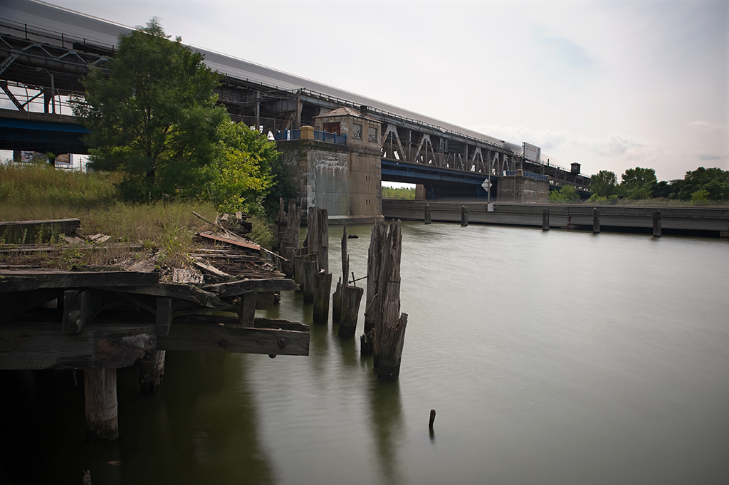
Bronx River Bascules

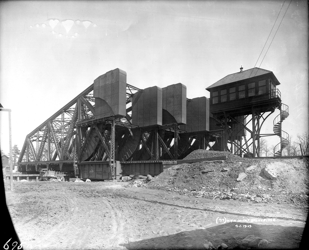
The three Bronx River Bascules as they were originally constructed, 1909 (Copyright: Bronx Historical Society)
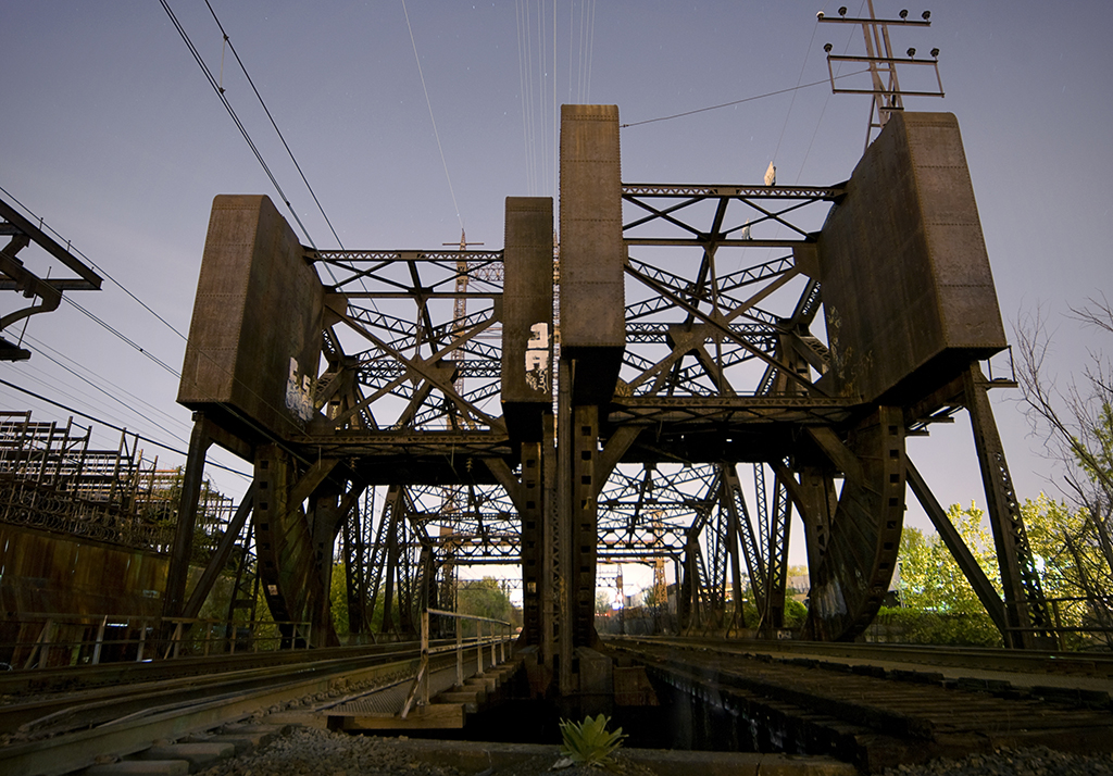
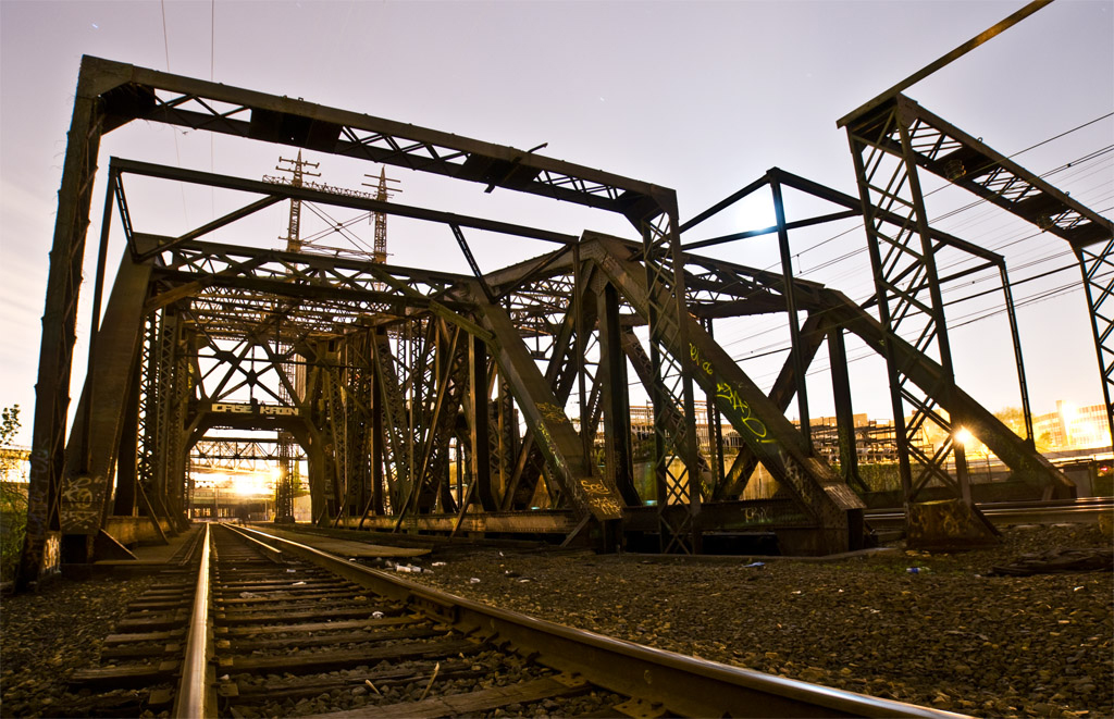
The current bridges, with the tower and one span removed

Location: Bronx River north of the Westchester Avenue Bridge, Bronx, NY [satellite map]
Carries: 3 railroad tracks (Amtrak and CSX)
Design: Scherzer Rolling Lift (bascule)
Date opened: summer 1908

The name “Bronx River Bascules” is not an official one. In fact, these bridges do not seem to have ever been given a proper name. The New York, New Haven & Hartford Railroad, which constructed them, referred to them simply as “bridge number 3.40” [1]. They cross the Bronx River just north of Westchester Avenue and were put into service in the summer of 1908.

The Harlem River Branch

The New York, New Haven & Hartford Railroad began running passenger and freight service on their Harlem River Branch in 1868. Two jackknife drawbridges carried trains over the Bronx River at the present site until 1893, when they were replaced by a four-track swing bridge. In 1907, the swing was removed and two temporary jackknife drawbridges were put in place. Between 1908 and 1910 the Harlem River Branch was completely rebuilt to carry six tracks and run on electricity. New stations were also built along the route. The closest was the Westchester Avenue station, which stands in ruins today to the south of the bridges, local passenger service having been discontinued in the 1930s.
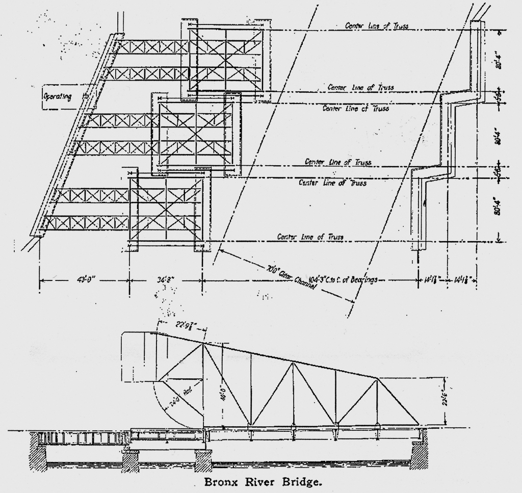
Diagram showing original configuration (Source: The Engineering Record)

Construction

The bridge superstructure, as originally built by the Pennsylvania Steel Company, was made up of three parallel two-track spans with separate piers on each end, staggered to accommodate the curve of the Bronx River (see diagram). Since the channel is so narrow (about 100 feet wide), the type of bridge chosen was a bascule, which did not obstruct the waterway as the swing bridge had. The particular type of bascule is the Scherzer Rolling Lift, invented by William Scherzer in Chicago; they operate by rolling back into the open position, rather than turning on a fixed axle as in other bascule designs. Since the Harlem River Branch was being electrified, tall towers were put up to carry high voltage wires above the bridges while in the open possition. Each leaf of the bridge was powered by two Westinghouse 25 horsepower, 550 volt direct current motors. All three leaves could be raised simultaneously in about a minute, and as a backup could be opened manually with a chain, though it was never necessary to do so.

Growth & Decline

About 200 trains passed over the bridges daily during their first years of operation; on average they opened 5 times a day during the winter and 12 times a day throughout the rest of the year [2]. With the opening of the Hell Gate Bridge by the New York Connecting Railroad in 1917, the Harlem River Branch became part of a much larger through route accommodating trains traveling from Penn Station to Boston. Over the years rail service declined, as did use of the Bronx River by boats requiring bridge lifts for passage. At some point, the tower containing the operating machinery and one two-track span were removed. The bridges now have only three tracks: one used by CSX for freight and two carrying Amtrak passenger trains on the Northeast Corridor Line.
012BronxBascules03

[ continue to references ]

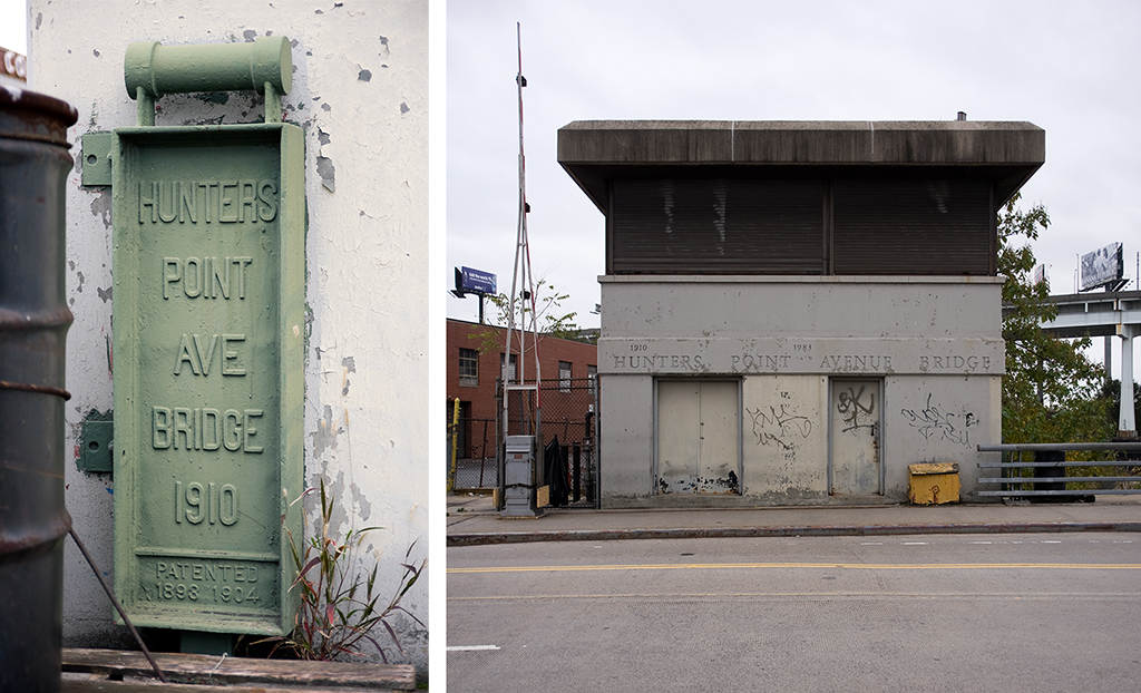
Hunters Point Avenue Bridge

Hunters Point Avenue Bridge

Location: Hunters Point Avenue over Dutch Kills, Queens, NY [satellite map]
Carries: 2 vehicular lanes, 2 pedestrian sidewalks
Design: bascule
Date opened: December 14, 1910

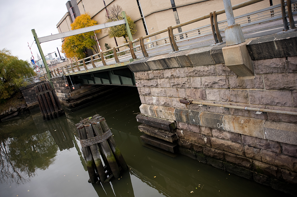
The Hunters Point Avenue Bridge carries the street bearing its name across Dutch Kills, a tributary of Newtown Creek, in Long Island City, Queens.

The Need for Movable Bridges

The section of Queens now known as Long Island City was originally low-lying marshland dotted with small towns. In 1861 the Long Island Railroad arrived after relocating its main terminal from Atlantic Avenue in Brooklyn to Hunters Point in Queens (a ferry leaving 34th Street carried passengers across the East River to Hunters Point). With the area rapidly industrializing, in 1869 Hunters Point pushed to to be incorporated into a larger, more important entity, combining with Ravenswood and Astoria. Thus, in 1870 Long Island City was born. Industry boomed, and gas and chemical plants along with various other types of factories took over much of the marshland. Of course, no regulations existed at the time to dissuade the dumping of toxic by-products into the waterways, and Newtown Creek and Dutch Kills both suffered sorely from this industrial pollution. Both rivers were heavily used and required bridges that allowed the waterways to remain navigable, so a large concentration of movable bridges is seen in the area.

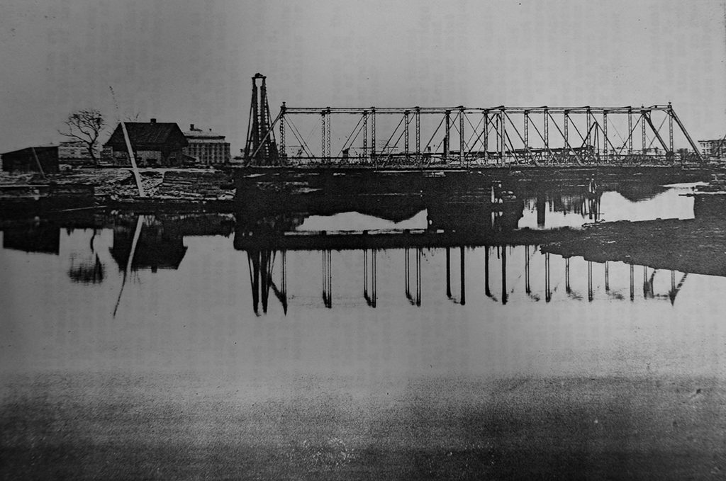
The Iron Bridge
The Iron Bridge, 1867-1907 (Source: Historical Facts in Connection with New York City Bridges)

Previous Bridges

Prior to 1874, Dutch Kills was crossed at Hunters Point Avenue by a wooden bridge. With so much industry moving in to the area, it was soon inadequate and was replaced in 1874 by an iron drawbridge. The iron drawbridge was problematic, and frequently had to be put out of service to be repaired. The bridge was poorly maintained and it was obvious something had to be done to keep navigation on Dutch Kills open. In 1906, Bridge Commissioner James W. Stevenson wrote to Queens Borough President Joseph Bermel requesting that since the bridge was over navigable water it ought be operated by the Department of Bridges. Bermel agreed, and on January 25, 1906, the bridge was put under the jurisdiction of the Department of Bridges, having just been put back into working order by the Department of Highways. By March 1907, it was found that the west abutment had been pushed forward by the ever-shifting marshland and the bridge could no longer close. The iron bridge was closed to traffic permanently and the Department of Bridges began planning for its replacement.

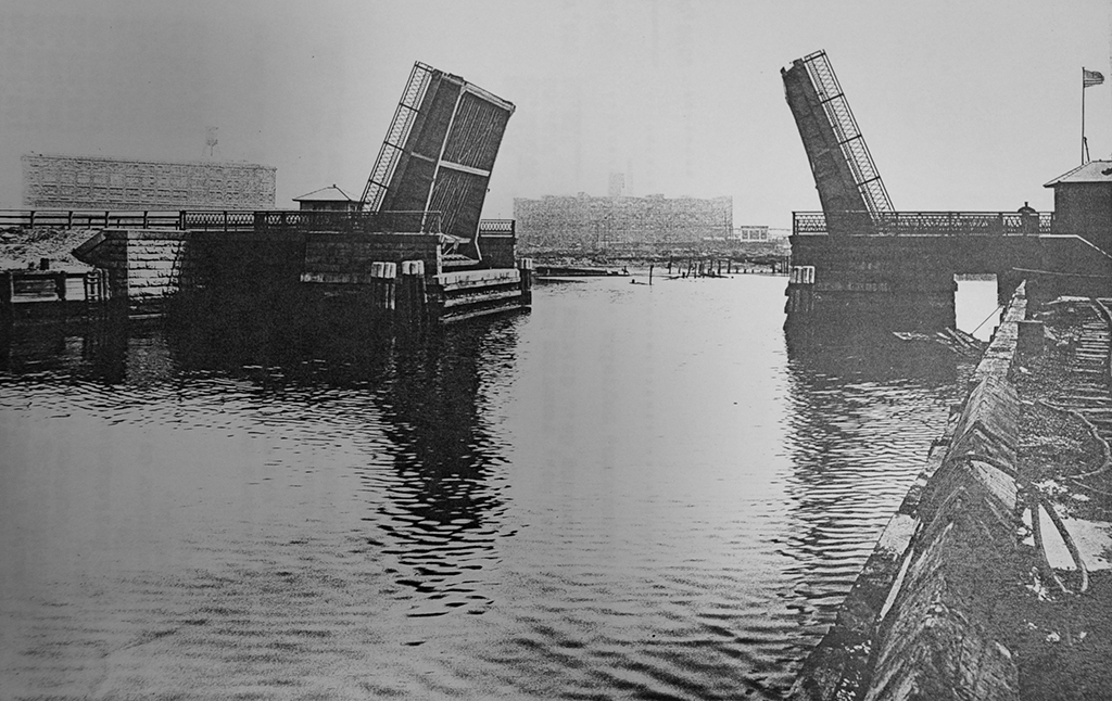
The Scherzer Rolling Lift Bridge
The Scherzer Rolling Lift Bridge, 1910-1983 (Source: Historical Facts in Connection with New York City Bridges)

The Scherzer Rolling Lift Bridge

The design approved by the Art Commission on April 13, 1909 was for a double-leaf Scherzer Rolling Lift bascule bridge. Bids were received in July; the North-Eastern Construction Company was the lowest at $95,214.11 and was given the contract to build the bridge. Construction began on July 13, 1909 and the bridge opened to traffic on December 14, 1910. The final cost was $102.985.56, about $8000 over the bid but still under the $110,000 budget allotted to it by the Department of Bridges.

Rebuilding

By the 1970s, following decades of neglect, many of New York City’s bridges were in need of major rehabilitation. The Department of Transportation released its first-ever survey of bridge conditions in 1978 and the Hunters Point Avenue Bridge was included on the “poor” list. This was for good reason: the previous year it had been closed entirely because parts of it had rotted away, rendering it unsafe for traffic. It was repaired just enough to handle cars, but a major rehabilitation was needed. In 1983 it was rebuilt as a single-leaf bascule bridge with a span of 21.8 meters, using the foundations of the Scherzer bridge. It celebrated its 100th birthday in December 2010, which was marked by a walking tour hosted by the New York City Bridge Centennial Commission and the Newtown Creek Alliance.

bridge house
bridge house

[ continue to references ]

Roosevelt Avenue Bridge

Roosevelt Avenue Bridge

Crosses: Flushing River
Connects: Corona and Flushing, Queens, NY [satellite map]
Carries: 4 vehicular lanes, 2 sidewalks, IRT 7 subway
Design: double-leaf bascule
Date opened: May 14, 1927

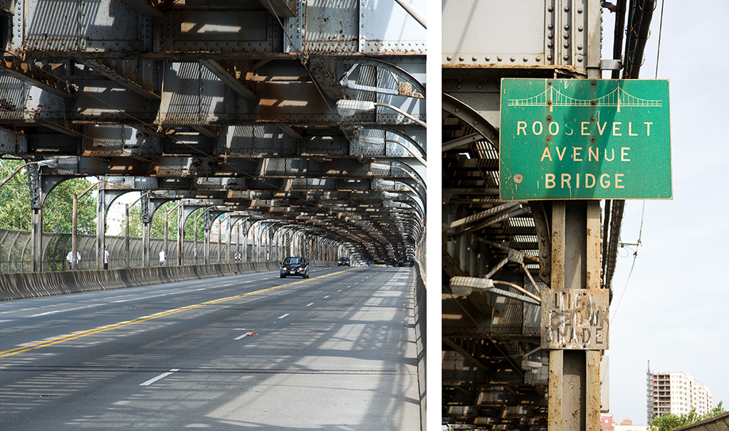
The Roosevelt Avenue Bridge is a double-deck, double-leaf bascule movable bridge over the Flushing River in northeastern Queens. It carries four lanes of Roosevelt Avenue and two sidewalks on its lower deck, and three tracks of the IRT Flushing / 7 train line of the New York City Subway on its top.

Planning

Surveying for the bridge began in 1913 as part of an extension of the Interborough Rapid Transit Company’s Woodside and Corona line. The original plan had the line mapped out between 42nd Street in Manhattan and Prime Street in Corona, with the extension reaching out to the village of Flushing, with a possible further extension to Little Neck at the city line. The line reached Corona in 1917, but United States involvement in World War I prevented further construction. Financial problems after the war delayed progress still until 1921, when city engineers began negotiations with the US War Department concerning what type of structure the city could build to cross the Flushing River. The War Department, which had jurisdiction over all navigable waterways and their crossings in the country at that time, denied a request by the city to be allowed to build a simple fixed bridge across the river on account of it being an obstruction to river traffic. A tunnel was briefly considered, but was decided against when cost estimates for it reached $2,500,000, more than the city was willing to pay. The War Department suggested the city build a bascule bridge, and officials relented.

Construction

Groundbreaking for the bridge was held on April 21, 1923 in a ceremony attended by Mayor John Hylan and Maurice E. Connolly, Borough President of Queens. Construction began soon after, though many delays occurred due to a recurring problem with the foundations of the bridge settling in the deep mud on the banks of the river. On May 14, 1927, the bridge was opened to pedestrians and a bus line was established between downtown Flushing and Willet’s Point Boulevard station, the temporary terminal of the line while the foundation issues were being resolved. Train service would not begin across the bridge until January 21, 1928, with a special train for city officials making the inaugural run from Time Square to the new station in Flushing. The extension to Little Neck has yet to be built.

view from the walkway
Roadway and sign

The final cost of the bridge was $2,640,000, more than the estimated cost of a tunnel under the river, even when adjusted for inflation. Despite the additional cost the city was required to pay for a movable bridge, the need to keep the river open to navigation did not last long. When construction of Flushing Meadows Park was under way in 1939, park engineers realized a dam was needed to keep the tides of the East River from inundating the low-lying fields. The Long Island Railroad, which runs just a few hundred feet upriver from Roosevelt Avenue, agreed to replace the swing bridge they owned over the river with a combined embankment and tidal gate on top of which they would continue to operate their trains. With no docking facilities in place between the two structures, navigation of the Flushing River effectively ended at the Roosevelt Avenue bridge. In 1961, construction of the northern extension of the Van Wyck Expressway began, and the route of the highway was driven directly through the navigation channel of the bridge, supported over the river by concrete piers. The operating mechanisms and bridge tender’s controls were finally removed at that point, and the bridge has not opened since.

Design

The Roosevelt Avenue bridge was the largest trunnion bascule bridge in the world when it was completed. It was designed by Edward A. Byrne and Robert E. Hawley of the NYC Department of Plants and Structures, and built by the Arthur McMullen Company of New York. The channel of the river at the point of the bridge is only 70 feet wide, but because of the skew of the route over the river, the clearance between the bridge piers is 162 feet. Together, the lift leaves are 153 feet long, and each weighs approximately 4 million pounds, supported by a truss structure 25 feet 6 inches deep. The piers that support the leaves are of poured concrete construction, with granite blocks covering the facings exposed to the water. Each pier measures 92 feet by 118 feet, and contains a large hollow space inside to accommodate the movement of the bridge’s counterweights.

Future

In January, 2010, the NYC Department of Transportation announced plans to rehabilitate the bridge starting in 2012. Years of neglect have resulted in a need to replace the road deck, repaint and repair rust on the steel truss and approach structures, and repair deteriorating concrete. The city also plans widen the sidewalks from 8 to 10 feet and establish bike lanes within them. The project is expected to be finished in 2015.

Update (04/29/2015): Rehabilitation has been delayed and is now expected to begin in mid-2015 with an end date to be determined.

[ continue to references ]

South Front Street Bridge

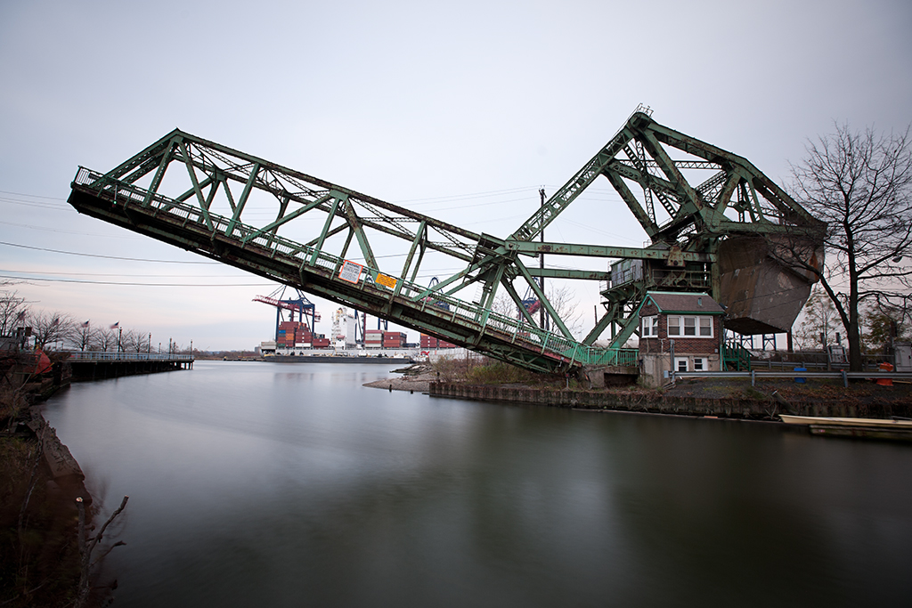
South Front Street Bridge in open position

Crosses: Elizabeth River
Location: Carries South Front Street over the Elizabeth River near its outlet into the Arthur Kill, Elizabeth, NJ [satellite map]
Carries: 1 vehicular lane, 1 pedestrian sidewalk
Design: Strauss heel trunnion bascule bridge
Date opened: 1922

The South Front Street Bridge is located just before the Elizabeth River opens up into the Arthur Kill, along the waterfront in Elizabeth, NJ.

Plans for a movable bridge at South Front Street were approved on July 3, 1916 by the Secretary of War. A riparian grant (a deed granted for normally state-owned tidelands) was obtained for $260 from the state of New Jersey in 1917, officially allowing the bridge to be constructed by the City of Elizabeth. The American Bridge Company built the bridge, beginning in 1920; it opened to traffic in 1922.

Design

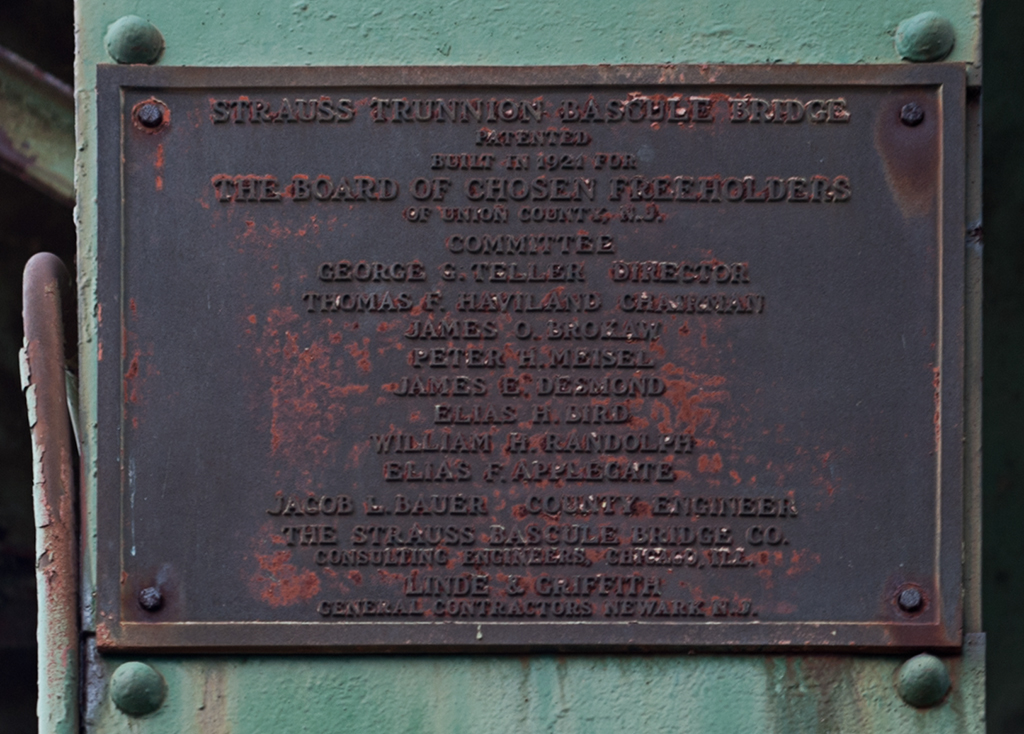
The South Front Street Bridge is a Strauss trunnion bascule bridge; it was designed by the Strauss Bascule Bridge Company, headed by Joseph Strauss in Chicago. Strauss patented the Strauss bascule design of the trunnion type, which open on a fixed axle. The South Front Street Bridge is a heel trunnion, which is a variation on the design, and is the only remaining road-carrying bridge of its type in New Jersey (though there are still several heel trunnion railroad bridges in the state). The heel truss has the advantage of taking up less space than traditional bascule designs, thus requiring less construction material.

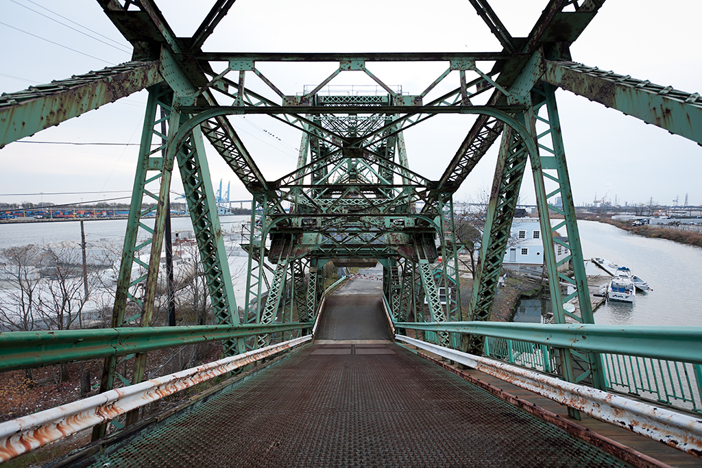
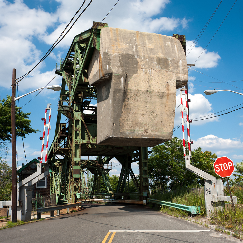
The bridge is skewed, so its trusses are of different lengths: 131’ 8” on the west side and 116’5” on the east. The bridge’s substructure and massive counterweight are made of concrete, which has undergone repairs several times. A small brick bridge house is located adjacent to the bridge; inside are the controls. The machinery which operates the bridge is on the bridge above the road; it consists of original gears and electric motors which were added in 1940.

The bridge was originally built with a wooden roadway, but it was replaced with a steel deck in 1956. The pedestrian walkway is still constructed of wood, though not the original wood deck. The bridge underwent significant repairs in 1976.

bridge deck
View from the bridge deck; the Chemical Control site is to the left.

The Elizabeth River’s Decline

The Elizabeth River was once home to six movable bridges, to accommodate its heavy use by ocean-going vessels. However, shipping on the river came to an end soon after the the 1951 opening of the New Jersey Turnpike. The U.S. Corps of Engineers deemed that three of the movable bridges would become fixed later in the 1950s. Another of the six (the Baltic Street Bridge) had been left isolated by the Turnpike construction, and it was sold for scrap in 1954. The South First Street Bridge, built in 1908, suffered a fire in the bridge tender’s house in 1984. With its control center gone, it permanently remained closed. The bridge was replaced completely in 2010. This leaves the South Front Street bridge as the only remaining operational drawbridge in all of Union County.

Only a few hundred feet of the Elizabeth River are still navigable, so the waterway only sees vessels designed for recreation, not industry. Still, a 2003 publication about Elizabeth estimated that the bridge was opened an average of 2,000 times a year [1].

Contamination Next Door

The bridge sits adjacent to the former site of the Chemical Control Corporation, a notorious part of New Jersey’s history with chemical dumping. The property, bordering on the southeastern end of the bridge, was originally marshland, but was filled in when Elizabeth developed much of its land for industrial use during the latter half of the 19th century. The Chemical Control Corporation was in operation from 1970 to 1978 as a disposal facility for hazardous waste. The company, which began as a legitimate business, became more notable for its practice of disposing of waste illegally, and was cited repeatedly until the state forced it to close in March of 1979.

concrete counterweight

The New Jersey Department of Environmental Protection began cleanup at the site shortly after; about 400,000 gallons of bulk solids and liquids, infectious and radioactive waste, and explosive liquids were removed. In May, upon hearing that the cleanup had uncovered nitroglycerin and other potential explosives, Elizabeth’s mayor Thomas G. Dunn declared a state of emergency in the area a half mile around the site, restricting pedestrian and vehicular traffic. The cleanup and restrictions were fortunate, because on April 21, 1980 there was an explosion at Chemical Control which led to a fire of spectacular proportions: drums of waste were launched into the air and exploded over the Arthur Kill; it took 10 hours to get the blaze under control but firefighters spent weeks at the site. NJDEP continued its cleanup and investigations after the fire; unfortunately, many of the records of which companies were connected to which hazardous materials were stored on-site and therefore lost.

In October 1981, it was proposed that the Chemical Control site be included on the National Priorities List of Superfund sites; its inclusion was finalized in September 1983. Cleanup continued, and a 1985-6 study found that contaminants including PCBs, naphalene, and benzene were still present in the soil, groundwater, and surface water. A slurry wall was later constructed around the site and anchored into a layer of clay under it; this helped stop groundwater contamination. A 2003 study of the site found that in general the contaminants which were contained during the cleanup remain contained, though it was noted that small area around the site may still be somewhat contaminated (one of three sampling stations still showed high levels of vinyl chloride and 2-butanone [2]).

plaque
plaque

The Bridge’s Future

In 2008, it was announced that the New Jersey Department of Transportation would supply $330,000 to repair the bridge. Work was done to reinforce the deck. The city was granted a further $1,000,000 in 2010 for more rehabilitation work. However, due to ongoing structural concerns, the bridge has been left in the open position since March 4, 2011; traffic is rerouted to the new South First Street Bridge. A study is underway to determine whether the bridge can be rehabilitated or not. The bridge remains eligible for the State and National Registers of Historic Places.

[ continue to references ]