Branch Brook Park Subway Bridges

Subway 1, East (East Arch)
Subway 2, West (West Arch)

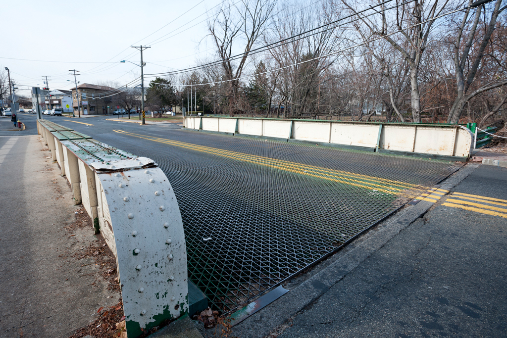
Location: Branch Brook Park, Newark, NJ [satellite map]
Carries: 2 vehicular lanes, 2 pedestrian sidewalks
Design: Arch bridge
Date opened: 1900
Postcard view: “Branch Brook Park West Arch Bridge”

Essex County, New Jersey is home to twenty Olmsted parks–those designed by firms headed by members of the prominent Olmsted family: Frederick Law Olmsted Senior or his nephew/stepson John Charles Olmsted and son Frederick Law Olmsted Junior [1]. The largest of New Jersey’s Olmsted parks is Branch Brook Park in Newark.

In 1867, after the New Jersey State legislature authorized the creation of a Newark Park Commission, Frederick Law Olmsted Sr. of Central Park fame recommended a site in Newark which would eventually become Branch Brook Park. Sixty acres of land were set aside for park use; Olmsted along with his partner Calvert Vaux planned for the park to be a “central park” for the City of Newark. In 1895 the Essex County Parks Commission was created, making Branch Brook Park the first public county park opened in the United States. Initially John Bogart and Nathan Barrett designed the park, and work on it began in 1896. However, the Parks Commission became dissatisfied with the romantic garden-inspired design and instead hired the Olmsted Brothers firm of John Charles Olmsted and Frederick Law Olmsted Jr. in 1898 to finish the park with a more naturalistic look. It was sixty acres large at its start, but over time has grown to nearly 360 acres; much of area was donated by prominent local families.

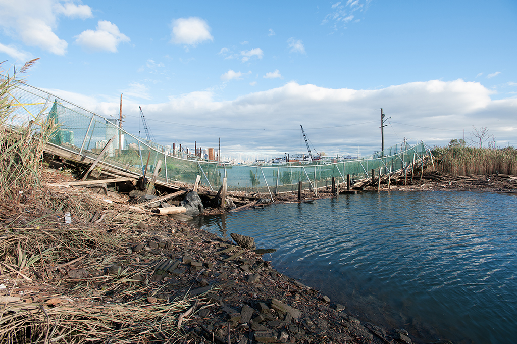
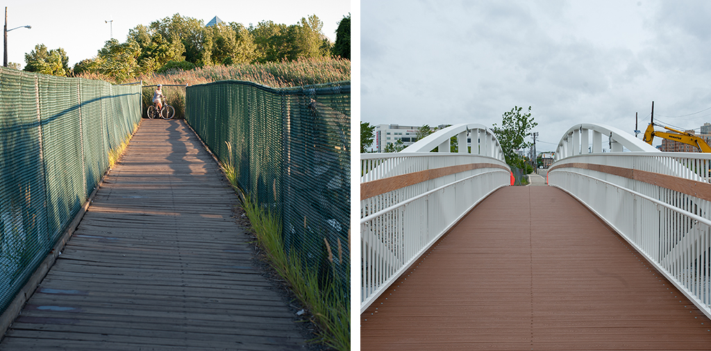
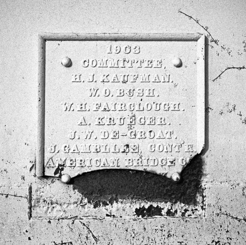
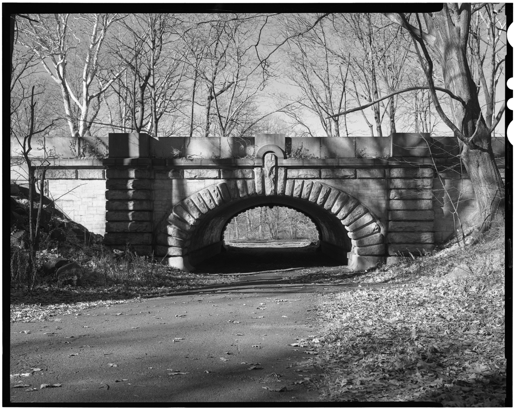
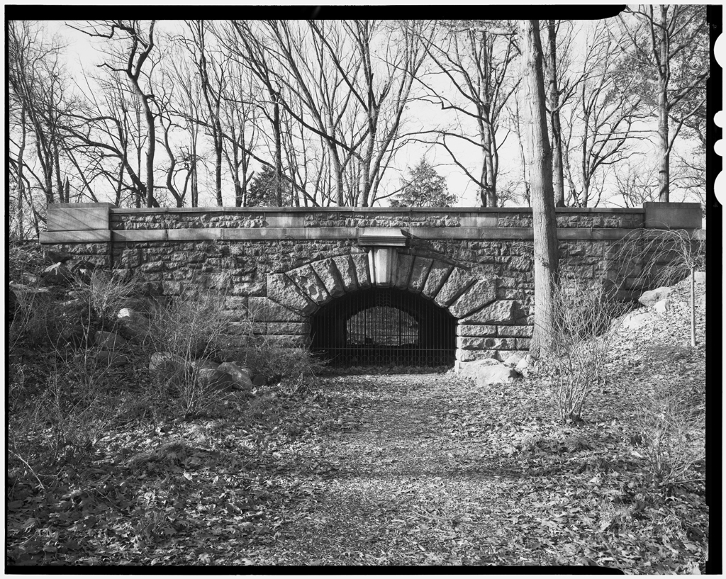
The park is home to many architecturally significant structures, including bridges, buildings, gates, and sculptures. Many of these were designed by the beaux-arts architectural firm of Carrère and Hastings headed by John Merven Carrère and Thomas Hastings. The pair designed two Subway Bridges now referred to as Subway 1, East and Subway 2, West. They were included in the initial Barrett and Bogart plan for the park but were redesigned and moved when the Olmsted Brothers took over; they were originally called the East Arch and West Arch. Both bridges have undergone rehabilitation work to remove graffiti, repair masonry, and remove vegetation where it is harmful to the structure.

Subway 1, East

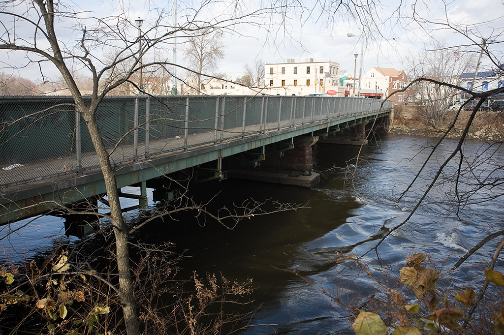
The East Arch was designed by Carrere & Hastings 1898 and constructed between 1989 and 1900. It is located on the eastern side of the Branch Brook Lake and was designed to help pedestrians avoid traffic on the park’s main thoroughfares, at the time used mainly by horses and carriages. An unpaved path passes under the granite bridge (hence the later naming of “subway”). The bridge is a stone arch design with a rustic granite masonry facing. Its railings are large granite blocks and its barrel-vaulted interior is lined with yellow bricks.

Subway 2, West

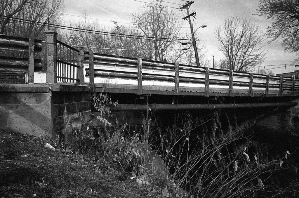
The West Arch is similar in design to the East Arch and was designed and built at the same time. The West Arch underpass was was at some point referred to as “Lovers’ Lane,” as seen in a ca.1911 postcard. However, it suffered more over the years than its counterpart in the east from neglect and vandalism–much more vegetation had infiltrated the structure and mineral deposits had formed within the arch to the point that stalactites hung from the ceiling; portions of the brick had fallen out entirely. The underpass is currently sealed off, so it is only possible to walk over, not under, Subway 2.

[ continue to references ]

Central Railroad of New Jersey Newark Bay Bridge

Newark Bay Bridge piers
Central Railroad of New Jersey Newark Bay Bridge piers, 2015

Crossed: Newark Bay
Connected: Elizabeth and Bayonne, NJ [satellite map]
Carried: 4 railroad tracks (Central Railroad of New Jersey)
Design: Vertical lift bridge
Date opened: November 27, 1926
Date demolished: 1980-1988

The Central Railroad of New Jersey Newark Bay Bridge was a two-mile-long vertical lift bridge which consisted of two spans that each carried two railroad tracks. The bridge crossed two shipping channels in Newark Bay and therefore had two lift spans, each with two draws that could be moved independently. The bridge carried both passenger and freight trains.

Previous Bridges

The Central Railroad of New Jersey, also known as the Jersey Central (and often shortened to CNJ), was a railroad that had its beginnings in the 1830s. Originally called the Elizabethtown and Somerville Railroad, it connected Elizabethport and Elizabeth, NJ in 1831 before extending outward to Somerville in 1842. It was renamed the Central Railroad Company of New Jersey in 1849, as it continued its expansion by building new track and acquiring other railroads; by 1852 it reached Phillipsburg, on the Delaware River. The first bridge built by the CNJ across Newark Bay was a wooden trestle with a steel swing span that opened on a central pier. It carried two tracks and opened in 1864; this line ended at the Central Railroad of New Jersey Terminal, located on the Hudson River waterfront in what is now Liberty State Park in Jersey City (the original 1864 building was replaced in 1889 with the Romanesque structure which still stands).

A double Scherzer Rolling Lift bridge replaced a swing bridge in 1904. (Source: Engineering-News Record, Vol. 49, No. 9)
A double Scherzer Rolling Lift bridge replaced the 1864 swing bridge in 1904. (Source: Engineering-News Record, Vol. 49, No. 9)

In 1903, work was begun on a replacement for the wooden bridge. Maritime traffic had increased steadily, and the volume and size of the trains crossing the bridge had also grown. The swing span had to open frequently and the CNJ also wanted to plan for an expansion of the crossing from two tracks to four. The design selected consisted of two Scherzer Rolling Lift spans; a key advantage over the swing bridge was that the bridge would not need to open fully to allow passage of barges and other low ships. The two-track sections could be expanded to four by building an additional span with identical Scherzer Rolling Lifts next to the existing spans. The west leaf of the movable span was floated into place on February 14, 1904 [1] and followed by the east leaf a few months later. The new span was seen as a vast improvement over the wooden trestle.

From Newark Meadows to Port Newark

However, the character of Newark Bay continued to change. The city of Newark began dredging the shallow Newark Meadows during the 1910s to create an additional shipping channel, which later became Port Newark (it is now known as the Port Newark-Elizabeth Marine Terminal). During World War I the U.S. government used Port Newark to station troops. The Port Authority of New York and New Jersey was formed in 1921 and was followed by the Rivers and Harbors Acts of 1922, which authorized the creation of even more shipping channels. As the crossing closest to the new facilities and the longest crossing, the bridge came to be seen as a huge obstruction to the growing port [2]. Authorities in Newark were in favor of demolishing the bridge altogether and replacing it with a tunnel (which wouldn’t obstruct marine traffic at all). Cost was an issue; a tunnel was estimated at $100 million whereas a replacement bridge would cost $9 million. Proposed by the CNJ in 1922, the replacement bridge, of a vertical lift design, would have two spans (200 feet and 125 feet wide) that would raise for a maximum clearance of 135 feet above the water; they would replace the Scherzer spans which were 85 feet wide each. U.S. Secretary of War John W. Weeks decided in favor of a vertical lift bridge in December of 1922 [3]. However, that was not the end of opposition to the bridge. In November, 1924 a case was brought to the Supreme Court against the CNJ by the state of New Jersey (led by Newark and Jersey City), questioning the right of a railroad to build across a state’s navigable waters [4]. On March 2, 1925 the Supreme Court decided in favor of the railroad [5] and plans to replace the bridge moved forward.

Vertical Lift Bridge

Vertical lift draws in the open position, looking north (Source: Historic American Engineering Record, NJ-37-42)

The Central Railroad of New Jersey sped construction of the new bridge as soon as approval had been granted. The bridge’s designer was John Alexander Low Waddell, a civil engineer well known for his vertical lift bridges. Waddell had moved to New York City in 1920 and was towards the end of a bridge-building career that had begun with a lift bridge in Chicago in 1892-3. The bridge was “believed to be the world’s longest drawbridge” [6]; the bridge’s Chief Engineer Arthur E. Owen declared it to be “the largest drawbridge assembly in the world” [7]. While neither claim was ever definitively proven, it would be hard to argue that the bridge was not impressive. The new spans carried four tracks over Newark Bay; the two shipping channels were crossed by double vertical lift spans that each operated separately from one another. The main difference in the functionality of the new bridge was that its height in the closed position was a minimum of 35 feet above the water, so while the Scherzer Rolling Lift improved upon the previous swing in that it only had to open partially for barges, the new bridge spans only had to open at all for taller ships (allowing the passage of many vessels at all times).

The new Central Railroad of New Jersey Newark Bay Bridge was formally opened on November 27, 1926. It had cost roughly $14 million (far higher than the original $9 million estimate several years earlier). The inaugural train riders included twenty-two “veteran” commuters of the line, most notably a resident of Elizabeth named K.S. Kiggins, who had also attended the first bridge opening in 1864 [8]. New Jersey governor Harry A. Moore, several New Jersey mayors, CNJ president Roy B. White, and many holding high positions at various other railroads were also in attendance. In 1927, W.C. Hope, the passenger traffic manager of the CNJ, released statistics stating the the new bridge had allowed 60% of all marine traffic to pass below it without opening, a steep decline in openings compared to the older bridge [9].

Tragedy

At 10am on September 15, 1958, a CNJ commuter train heading towards Bayonne from Bay Head plunged off the south span, which was partially lifted, and into Newark Bay. The train had proceeded past three stop signals; evidence of mechanical failure was never found and it was believed that the engineer had suffered a heart attack. After a dramatic rescue and recovery effort over the next several days, it was declared that 48 people had died in the tragedy–45 passengers and three crew members. Notable among the dead were former second baseman for the Yankees George (Snuffy) Stirnweiss and John Hawkins, the mayor of Shrewsbury, NJ. Later in 1958, the CNJ announced it would be adding new safety measures: automatic trippers would bring rogue trains to a stop if they ignored stop signals (by using a derail system), and “dead-man” controls would stop trains if the operator released the throttle [10].

Abandonment and Demolition

Deck of vertical lift span (Source: Historic American Engineering Record, NJ-37-16)

The bridge was in for more trouble, however. On a very foggy May 19, 1966, the French freighter S.S. Washington hit the northeast vertical lift span, rendering the two tracks it carried unusable. Furthermore, he overall decline of the railroads was taking its toll on the CNJ; overall ridership was down and in May 1967 the Aldene Plan went into effect. It rerouted CNJ trains departing from Aldene (in Roselle Park, NJ) to Newark rather than over the Newark Bay Bridge. This meant that the only passenger service over the bridge was a shuttle running from Bayonne to Cranford; nicknamed the “Scoot,” its service was very limited. In light of these changes, the damaged span was never repaired.

Use of the bridge continued its steady decline. By the 1970s, CNJ had moved the rest of their freight operation to Elizabeth and only two freight trains a day crossed the span.The Consolidated Rail Corporation (Conrail) took over the operations of the Central Railroad of New Jersey on April 1, 1976 and moved all freight operations to the Pennsylvania Railroad Newark Bay Bridge, north of the CNJ span. The last passenger train crossed the bridge was on August 6, 1978.

The abandoned bridge was deemed a hazard to navigation and an attempt was made to save the bridge by the City of Bayonne. The city was unsuccessful, and on July 11, 1980 explosives were used to partially demolish the bridge. The vertical lift spans and towers fell, engulfed in smoke. The approaches and remaining trestles were removed in 1987-1988, leaving only portions of the piers along the shorelines as visual reminders of the structure that once crossed the bay. The Bayonne Historical Society held a memorial for victims of the commuter train crash in 2008, 50 years after the accident, but other than that the bridge has been largely forgotten. Some remaining portions of the bridge were blasted away as recently as February, 2012 [11]. On the Bayonne waterfront, cormorants and seagulls can be seen roosting on the few crumbling piers that still extend into Newark Bay today.

CRRNJ Newark Bay Bridge piers, 2015
Central Railroad of New Jersey Newark Bay Bridge piers, 2015

[ continue to references ]

Midtown Bridge

Midtown Bridge from Oscar E. Olsen Park in Bogota, 2015

Crosses: Hackensack River
Connects: Hackensack and Bogota, NJ [satellite map]
Carries: 2 vehicular lanes, 1 sidewalk
Design: (former) swing bridge, fixed into place in 1984
Date opened: 1900

The Midtown Bridge, also known as the Salem Street Bridge and William C. Ryan Memorial Bridge, is a fixed through truss bridge that was formerly a swing bridge. It spans the Hackensack River, connecting Hackensack and Bogota in Bergen County, New Jersey.

Midtown Bridge-03
Passaic Rolling Mill Co. founder’s mark on steel beam

The bridge was originally built in 1900 by F.R. Long and Company as a trolley bridge for the Bergen County Traction Company. Steel for the bridge was provided by the Passaic Rolling Mill Company of Paterson, NJ. The bridge’s original design was a through Pratt truss swing span on a stone center pier and it carried two sets of tracks. The Bergen County Traction Company had been formed in 1894, and opened in 1896, connecting ferry passengers traveling from Manhattan to Edgewater to trolley lines to Fort Lee, Leonia, Englewood, Teaneck, Bogota, and Hackensack. The lines were consolidated in 1900 into the New Jersey and Hudson River Railway Company and later sold to the Public Service Corporation of New Jersey in 1910. The Bergen Division of the Public Service Railway continued to carry trolleys over the Hackensack (a 1937 image can be seen in Figure 139 (page 189) of Streetcars of New Jersey: Metropolitan Northeast [1]).

However, with the rise of the automobile, transportation was changing, and trolley routes began to be replaced by buses. By 1938 all trolleys had been discontinued in Bergen County; the bridge’s tracks were replaced with a steel deck and in 1940 the Midtown Bridge began carrying vehicular traffic. It continued to operate as a swing bridge until a rehabilitation project in 1984, when it was fixed in place and its machinery was removed. In 1980, the bridge was given the additional name of “Ryan Memorial Bridge,” named after Bogota resident and U.S. Marine Corps Lieutenant William C. Ryan, who was killed in North Vietnam in 1969.

Steel deck, 2010
Steel deck, 2010
Ryan Memorial Bridge plaque

The Midtown Bridge has only recently been notable for being in need of repair. It was shut down for several weeks in 1998 by the Department of Public Works so that emergency repairs could be made to its steel joints. The issue was described by county engineer Robert Mulder as “an ongoing problem that needs to be permanently fixed” [2]; however, that fix has been continually delayed. A project to rehabilitate the Court Street Bridge, another former swing bridge in Hackensack downriver from the Midtown Bridge, meant that it was closed from 2010-2012, with much of the Court Street Bridge’s traffic diverted to the Midtown Bridge during that time. On October 17, 2013 the Midtown Bridge was shut down for emergency repairs again; Bogota’s Council President and Office of Emergency Management coordinator Tito Jackson had noticed a large separation in the bridge’s metal decking at its joints [3]. The current plan is to replace the aging span with a bridge with a concrete deck. Bergen County is home to a number of bridges in need of major repair or replacement, so there is no timetable for the project as of yet.

[ continue to references ]

Mill Creek Footbridge

Replacement Mill Creek Footbridge, 2013

Crosses: Mill Creek
Connects: Jersey Avenue and Liberty State Park, Jersey City [satellite map]
Carries: Pedestrian/cyclist sidewalk
Design: Arch bridge
Date opened: May 23, 2013

The Mill Creek Footbridge connects Jersey Avenue in downtown Jersey City, NJ with Philip Street in Liberty State Park. The current bridge replaced an older structure that was destroyed on October 29, 2012, during Hurricane Sandy. Mill Creek feeds into the Morris Canal Basin (now used as a marina) and then the Hudson River.

Original Bridge

Little information is available about the original bridge. Taking into account that maps may be inaccurate, it appears that a Jersey Avenue road bridge crossing Mill Creek was built sometime between 1874 and 1889. A railroad bridge running parallel to it was constructed by 1904. The railroad trestle carried both the Lehigh Valley Railroad and the Central Railroad of New Jersey. Both lines terminated before crossing the Morris Canal to the north (the canal was located just south of Grand Street). The road portion was demolished at some point between 1928 and 1955. Following the decline of the railroads in Jersey City, the trestle was abandoned and the bridge was converted into a footbridge sometime thereafter. The Jersey Journal notes that city officials do not know exactly when the bridge became a footbridge, and Sam Pesin (president of the group Friends of Liberty State Park) thinks it was there when the park opened in 1976 [1].

Original Mill Creek Bridge, 2010

The Jersey Avenue Extension

Various proposals have been made over the last twenty years or so to extend Jersey Avenue over Mill Creek, connecting Downtown with Liberty State Park, as well as providing additional access to the New Jersey Turnpike. The city applied for an $18.4 million federal grant in 2011 to fund the extension. The proposal argues that the extension would ease traffic in the nearby Bergen-Lafayette neighborhood. However, it has also sparked debate among residents over how much local streets would be impacted by cars exiting the Turnpike to avoid traffic at the Holland Tunnel; cars cutting through local Downtown streets have long been an issue. The proposal acknowledges this and tries to defend its position:

The city is also mindful that this new direct connection could be perceived as a short cut for out-of-town commuters by using the 1.2-mile corridor between New Jersey Turnpike Exit 14B and Grand Street to access Jersey City’s central business district or the Holland Tunnel. This corridor traverses Liberty State Park and residential development areas. To achieve the overall goal of improved connectivity and access without increasing traffic speeds and/or inducing additional traffic through the environmentally sensitive park areas or future residential neighborhoods, a series of modern roundabouts are proposed in the park segments and a more pedestrian friendly “complete street” is proposed in the northern segment of dense urban development. [2]

The city was not given the grant and the footbridge was destroyed the following October during Sandy. Initially, it was speculated that the city would not replace the footbridge at all, in hopes that it would be able to begin construction on the Jersey Avenue Extension, which would include a pedestrian pathway. However, it was decided that the footbridge would be replaced (a widely-held suspicion is that it was given priority because 2013 is an election year). In March of 2013, Jersey City was awarded $500,000 by the federal government to do a feasibility study for a road extension; that proposed bridge would run parallel to the new footbridge, which was set to open by Memorial Day weekend.

Hurricane Sandy damage, November 2012

The new Mill Creek Footbridge was delivered on May 1 and opened on May 23rd. It is a prefabricated arch bridge that is painted white; it has a somewhat higher clearance over the creek than its predecessor. It was scheduled to cost about $750,000 and wound up costing about $800,000. Jersey City has applied to the Federal Emergency Management Administration, which could reimburse the city for most of the cost of the bridge. It is officially called the Ethel Pesin Liberty Bridge, in honor of a founding trustee of Friends of Liberty State Park (and wife of Sam Pesin). She died in February, 2013, at age 98.

Original walkway, 2010 (left); Replacement walkway, 2013 (right)

[ continue to references ]

Monroe Street Bridge

Monroe Street Bridge

Crosses: Passaic River
Location: Monroe Street connecting Passaic and Garfield, NJ [satellite map]
Carries: 2 vehicular lanes, 1 pedestrian sidewalk
Design: arch bridge
Date opened: June 13, 1908
Postcard view: “Monroe Street Bridge, Passaic, N.J.”

The Monroe Street Bridge is a reinforced concrete arch bridge over the Passaic River in New Jersey, connecting the towns of Passaic and Garfield.

Gilbert D. Bogart & East Passaic

In early 1873, Gilbert D. Bogart set out to develop a suburb to the town of Passaic, which he called East Passaic. He and his associates formed the East Passaic Land Company and bought property along the Passaic River from Monroe Street to Van Winkle Avenue. His company was responsible for the first development in the area. In 1875, a bridge across the Passaic was built at Monroe Street by Joseph Scott, and seven houses were also constructed. However, the financial panic of 1873 brought Bogart’s project to a grinding halt. Lots on the land acquired by the East Passaic Land Company could not be sold even at greatly reduced prices. The company suffered heavy losses and years passed without any sign of recovery.

On December 8, 1878, Scott’s Monroe Street Bridge was washed away when the Passaic River overflowed its banks. In 1881, the Bergen County Short Cut (a branch of the Erie Railroad) was laid along Monroe street, and a rail bridge was built to Passaic (next to where the washed-out bridge had been); a station was created and named after President Garfield.

Rail bridge next to the Monroe Street Bridge

Things still were not improving for Bogart’s company, and in 1882 it sold all its land under foreclosure to the Garfield Land Association. The name “East Passaic” had become associated with failure and the town adopted the name of Garfield instead. The land was sold as individual lots by the Garfield Land Association with the remainder going to the newly formed Monroe Street Bridge Land Company, which built a replacement bridge shortly after.

The Current Bridge

The bridge currently crossing Monroe Street was built in 1908 by the C.W. Dean Company of New York. The plans for the bridge had been put together by F.R. Long Company Engineers and Contractors in August of 1907. It is a three-span, 306-foot long deck arch bridge on a concrete and stone substructure. The bridge is made up of three equal elliptical arch spans. It originally featured a decorative railing with vase-shaped balusters. The bridge was important to the industrial and commercial development of both Passaic and Garfield, and is the only existing pre-World War II multi-span concrete arch bridge remaining in the United States.

The Monroe Street Bridge opened on June 13, 1908. A parade was held and Mayor John Karl of Garfield and Mayor Frederick R. Low of Passaic met to officially open the bridge to the public. A celebration was held in a nearby park afterward.

Alterations

The Monroe Street Bridge has been repaired extensively over the years. In 1947 guide rail was added to the curbs, and new concrete curbs followed in 1948. Many repairs to the substructure were made using gunite (a dry form of shotcrete) in 1949. Large parts of the balustrades were missing or badly damaged, and they were replaced by a more utilitarian railing sometime after Bergen County did a survey the bridge in the early 1980s. New Jersey’s 2002 survey of the bridge deemed that it had lost much of its “visual integrity” due to the nature of the gunite repairs [1].

[ continue to references ]

Passaic River Bridge (1&9)

Passaic River Bridge with Pulaski Skyway in background

Crosses: Passaic River
Connects: South Kearny and Newark, NJ [satellite map]
Carries: 4 vehicular lanes, 2 sidewalks
Design: vertical lift
Date opened: January 26, 1941

Traveling east along the 1&9 Truck Route from Newark to Jersey City, you may notice a small steel plaque on the Passaic River crossing proclaiming that span to be 1941’s Most Beautiful Steel Bridge. That designation, given by the American Institute of Steel Construction, was awarded the year that bridge opened to traffic.

The bridge replaced a low level swing span that had been in place since 1921. That bridge, with a 10 foot clearance over the river, required an average of 30 openings a day to accommodate marine traffic, causing significant automobile traffic delays. Problems were exacerbated by the opening of the Holland Tunnel in 1927 as the final link between the interstate Lincoln Highway and New York City. Though the opening of the Pulaski Skyway, located just a short distance north of this route, was intended to alleviate these problems, the Skyway was effectively obsolete as soon as it was opened to traffic. The diversion of all truck traffic from the Skyway in 1933 further complicated problems along the route. Construction of a new span commenced in 1938, at a projected cost of two million dollars.

Design

The vertical lift design of the new bridge required the construction of two large steel towers on each side of the navigation channel, connected by a movable deck, which has a span of 332.5 feet. In the closed position, the new bridge provided 40 feet of clearance over the Passaic, reducing the number of daily bridge openings to an estimated 5 per day. Tower drive motors, a fairly new innovation at the time, were able to lift the deck 95 feet above its closed position, allowing for a maximum of 135 feet clearance, a minimum height specified by the War Department for marine crossings. The chief engineer was Morris Goodkind, with the firm of Howard, Needles, Tammen and Bergendoff as consulting engineers. The substructure was fabricated by Senior and Palmer and the superstructure by the American Bridge Company.

Plaque and bridge walkway

Construction

The Passaic River Bridge took three years to complete under the supervision of lead engineer Morris Goodkind and the New Jersey State Highway Commission, with the final cost just barely exceeding the projected estimate by just under $56,000. The bridge was constructed as close to the south side of the old span as logistically possible in order to ease the transfer of the traffic alignment from the old bridge to the new. During the final phase of construction, with everything in place except for the moveable deck, river traffic was halted for 72 hours while the deck could be installed.

In what must have been a very carefully choreographed procedure, the deck was floated into the work location on a barge at high tide and aligned with the rest of the structure. As the tide receded, the deck gradually sank into position on the bridge piers. After the 64 lifting ropes attached to the lift’s counterweights were connected to the deck, the bridge was essentially complete, save for some fine tuning needed to ensure proper bridge operation. It was opened to traffic at 11 PM on Sunday, January 14th, 1941.

[ continue to references ]

Passaic Street Bridge

Passaic Street Bridge

Crosses: Passaic River
Connects: Wall Street, Passaic and Passaic Street, Garfield, NJ [satellite map]
Carries: 2 vehicular lanes, 2 pedestrian sidewalks
Design: girder bridge
Date opened: 1898

The Passaic Street Bridge is the earliest known example of a multi-span through-girder bridge in Bergen County, New Jersey. It connects the towns of Passaic and Garfield and is the third bridge at that location.

The Iron Bridge

The first bridge to cross the Passaic River at Garfield was known as the Iron Bridge; it opened in 1868. On September 11, 1871, one of the bridge’s three spans collapsed while carrying a team of horses and a driver. All fell into the Passaic, and while the horses escaped without injury, their driver was killed. A decision was made to completely rebuild rather than repair, and a new Iron Bridge opened in 1872.

plaque
plaque

That bridge was replaced in 1898 with the current structure, again made of iron but also reinforced with cement. The engineers on the project were the Wise & Watson Company of Passaic. The builders were the F.R. Long Company. The bridge is 233 feet long and, like its predecessors, is composed of three spans resting on ashlar masonry abutments.

The Flood of 1903

The summer of 1903 brought above average rainfall, and a tropical storm hit the east coast in early October. For nearly two weeks the Passaic River overflowed its banks in what became known as the Flood of 1903 (still the largest on record for the area). Almost all the bridges downriver of the Great Falls in Paterson were washed away, but the Passaic Street Bridge managed to survive the torrents.

Alterations

The Passaic Street Bridge has undergone a few rounds of alterations, none of which are considered to impact its historic status [1]. Welded plates were added to the deck girders and concrete caps to the masonry below the bridge. In 1989 the bridge was rehabilitated, with the deck and stringers replaced and the floor beams mended.

011passaicst03
Passaic Street Bridge from the Passaic side of the river

[ continue to references ]

Passaic Street Bridge, Lodi

Passaic Street Bridge

Crosses: Saddle River
Location: Carries Passaic Street over the Saddle River in Lodi, NJ [satellite map]
Carries: 2 vehicular lanes, 2 pedestrian sidewalks
Design: Through-girder bridge
Date opened: 1903

The Passaic Street Bridge carries Passaic Street (which becomes Passaic Avenue and feeds into Main Street) across the Saddle River in Lodi, New Jersey. It was built by the American Bridge Company in 1903. It is a through-girder bridge that rests on stone abutments. In 1939 (and again in 1971), the girders underwent repairs and welded plates were added to strengthen them. Also in 1971, much of the original concrete encasement on the floorbeams was removed and a metal deck was installed. Some of the original metal railing remains on the span, and one partially-broken plaque gives information on the bridge’s construction. New Jersey’s 2002 Bridge Survey notes that the bridge is one of more than 20 of its type in the state, and due to the construction on it over the years, “the altered span has lost its visual integrity and it is not distinguished.” [1]

plaque
Bridge plaque

Though the bridge may not be unique in its construction, it is of a type that is frequently replaced with more modern spans, and over its 110-plus years in existence it has been witness to much change in Lodi.

Industry on the Saddle River

The town of Lodi has existed in some form since Revolutionary times, and the township of Lodi was organized in 1825, taking  its name from a town in Italy. The Saddle River was important to the growth of the town into a manufacturing center. By the late 1800’s, the river provided the power to two grist- and saw-mills, a bleaching and dyeing factory called United Piece Dye Works, and the Lodi Chemical Works. [2]

The borough of Lodi was incorporated in 1894 out of Lodi Township and Saddle River Township, during New Jersey’s period of “Borough Fever” of the late nineteenth century. Starting in 1894, New Jersey allowed new boroughs to be formed by petition, rather than as a special act of the state legislature. Bergen County took particular advantage of this–56 out of 70 total municipalities in the county are now boroughs.

United Piece Dye Works

The late 1890’s saw an influx of immigrants, mainly from Italy, coming to Lodi to work at the United Piece Dye Works. The factory was  just upstream from the current location of the Passaic Street Bridge on the Saddle River. The dye made there became a part of the landscape. Anthony Taormina, who was born in Lodi in 1954 and went on to become the director of its library from 1986 until his retirement in 2011, described the Dye Works’ effect on the the river:

“I remember my mother telling me about walking over the Passaic Street bridge on her way to school, looking at the different chemical colors coming down the Saddle River. One day it would be green, one day it would be blue, depending on what color they were dying that day.” [3]

Chemical Manufacturing

Plaque in Lodi Memorial Park commemorating the victims of the Napp Technologies explosion

During the Great Depression, much of the textile business that had been in and around Passaic, NJ  moved south in order to cut labor costs. United Dye Works closed in the 1950’s and soon chemical manufacturers moved into the town.

An explosion tore the roof off a building at the B.L. Lemke Company in April of 1969, killing one person and wounding six. In August of 1973, an explosion at the Mallinckrodt Chemical Company killed seven employees. After that incident, the town cracked down somewhat on the industry: it prohibited new chemical companies from moving in and prevented the existing ones from expanding further.

B.L. Lemke later became Napp-Lemke Chemicals, and later still Napp Technologies. In April of 1995 another explosion rocked the complex, killing five and injuring seven. Approximately 400 residents of Lodi were evacuated. The Saddle River turned a fluorescent green color from the chemically contaminated water runoff generated by firefighting efforts at the plant.

Lodi’s problems with chemicals weren’t limited to explosions. The town once got its water from natural wells, run by the Lodi Water Works. In 1983, they were shut down after it was discovered that they had been contaminated by thorium, a radioactive chemical made in Lodi by another chemical company. Water has been piped in from elsewhere ever since.

Legislation introduced after the Napp Technologies explosion prevented the company from reopening in Lodi. The area it once occupied now is parkland and a shopping area.

Flooding

The Saddle River has flooded many times over the years. In March 1902 the water rose 14 inches above the previous bridge. Though no information has been found to support this, it can be speculated that the bridge was replaced in 1903 because of damage done during the 1902 flood (this was the case with many bridges over the nearby Passaic River). An even larger flood occurred in October of 1913: the Saddle River reached a height of six-and-a-half feet above the bridge [4]. Floods continue today and local officials have attempted to pass legislation which would allow for dredging of the river, but the estimated cost of $100 million has held the project back [5].

replacement metal deck
Replacement metal deck

[ continue to references ]

South Front Street Bridge

South Front Street Bridge in open position

Crosses: Elizabeth River
Location: Carries South Front Street over the Elizabeth River near its outlet into the Arthur Kill, Elizabeth, NJ [satellite map]
Carries: 1 vehicular lane, 1 pedestrian sidewalk
Design: Strauss heel trunnion bascule bridge
Date opened: 1922

The South Front Street Bridge is located just before the Elizabeth River opens up into the Arthur Kill, along the waterfront in Elizabeth, NJ.

Plans for a movable bridge at South Front Street were approved on July 3, 1916 by the Secretary of War. A riparian grant (a deed granted for normally state-owned tidelands) was obtained for $260 from the state of New Jersey in 1917, officially allowing the bridge to be constructed by the City of Elizabeth. The American Bridge Company built the bridge, beginning in 1920; it opened to traffic in 1922.

Design

The South Front Street Bridge is a Strauss trunnion bascule bridge; it was designed by the Strauss Bascule Bridge Company, headed by Joseph Strauss in Chicago. Strauss patented the Strauss bascule design of the trunnion type, which open on a fixed axle. The South Front Street Bridge is a heel trunnion, which is a variation on the design, and is the only remaining road-carrying bridge of its type in New Jersey (though there are still several heel trunnion railroad bridges in the state). The heel truss has the advantage of taking up less space than traditional bascule designs, thus requiring less construction material.

The bridge is skewed, so its trusses are of different lengths: 131’ 8” on the west side and 116’5” on the east. The bridge’s substructure and massive counterweight are made of concrete, which has undergone repairs several times. A small brick bridge house is located adjacent to the bridge; inside are the controls. The machinery which operates the bridge is on the bridge above the road; it consists of original gears and electric motors which were added in 1940.

The bridge was originally built with a wooden roadway, but it was replaced with a steel deck in 1956. The pedestrian walkway is still constructed of wood, though not the original wood deck. The bridge underwent significant repairs in 1976.

bridge deck
View from the bridge deck; the Chemical Control site is to the left.

The Elizabeth River’s Decline

The Elizabeth River was once home to six movable bridges, to accommodate its heavy use by ocean-going vessels. However, shipping on the river came to an end soon after the the 1951 opening of the New Jersey Turnpike. The U.S. Corps of Engineers deemed that three of the movable bridges would become fixed later in the 1950s. Another of the six (the Baltic Street Bridge) had been left isolated by the Turnpike construction, and it was sold for scrap in 1954. The South First Street Bridge, built in 1908, suffered a fire in the bridge tender’s house in 1984. With its control center gone, it permanently remained closed. The bridge was replaced completely in 2010. This leaves the South Front Street bridge as the only remaining operational drawbridge in all of Union County.

Only a few hundred feet of the Elizabeth River are still navigable, so the waterway only sees vessels designed for recreation, not industry. Still, a 2003 publication about Elizabeth estimated that the bridge was opened an average of 2,000 times a year [1].

Contamination Next Door

The bridge sits adjacent to the former site of the Chemical Control Corporation, a notorious part of New Jersey’s history with chemical dumping. The property, bordering on the southeastern end of the bridge, was originally marshland, but was filled in when Elizabeth developed much of its land for industrial use during the latter half of the 19th century. The Chemical Control Corporation was in operation from 1970 to 1978 as a disposal facility for hazardous waste. The company, which began as a legitimate business, became more notable for its practice of disposing of waste illegally, and was cited repeatedly until the state forced it to close in March of 1979.

concrete counterweight

The New Jersey Department of Environmental Protection began cleanup at the site shortly after; about 400,000 gallons of bulk solids and liquids, infectious and radioactive waste, and explosive liquids were removed. In May, upon hearing that the cleanup had uncovered nitroglycerin and other potential explosives, Elizabeth’s mayor Thomas G. Dunn declared a state of emergency in the area a half mile around the site, restricting pedestrian and vehicular traffic. The cleanup and restrictions were fortunate, because on April 21, 1980 there was an explosion at Chemical Control which led to a fire of spectacular proportions: drums of waste were launched into the air and exploded over the Arthur Kill; it took 10 hours to get the blaze under control but firefighters spent weeks at the site. NJDEP continued its cleanup and investigations after the fire; unfortunately, many of the records of which companies were connected to which hazardous materials were stored on-site and therefore lost.

In October 1981, it was proposed that the Chemical Control site be included on the National Priorities List of Superfund sites; its inclusion was finalized in September 1983. Cleanup continued, and a 1985-6 study found that contaminants including PCBs, naphalene, and benzene were still present in the soil, groundwater, and surface water. A slurry wall was later constructed around the site and anchored into a layer of clay under it; this helped stop groundwater contamination. A 2003 study of the site found that in general the contaminants which were contained during the cleanup remain contained, though it was noted that small area around the site may still be somewhat contaminated (one of three sampling stations still showed high levels of vinyl chloride and 2-butanone [2]).

plaque
plaque

The Bridge’s Future

In 2008, it was announced that the New Jersey Department of Transportation would supply $330,000 to repair the bridge. Work was done to reinforce the deck. The city was granted a further $1,000,000 in 2010 for more rehabilitation work. However, due to ongoing structural concerns, the bridge has been left in the open position since March 4, 2011; traffic is rerouted to the new South First Street Bridge. A study is underway to determine whether the bridge can be rehabilitated or not. The bridge remains eligible for the State and National Registers of Historic Places.

[ continue to references ]