Marine Parkway Bridge

Marine Parkway Bridge

Crosses: Rockaway Inlet in Jamaica Bay
Connects: Floyd Bennett Field, Brooklyn and the Rockaways, Queens, NY [satellite map]
Carries: 4 vehicular lanes, 1 pedestrian sidewalk
Design: vertical lift bridge
Date opened: July 3, 1937
Postcard view: “Marine Parkway Bridge, Brooklyn, N.Y.”

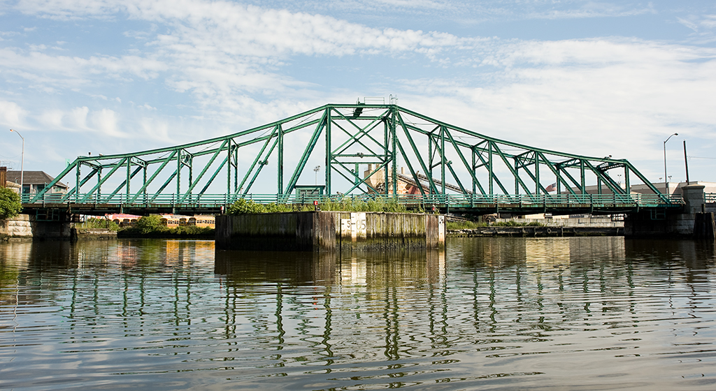
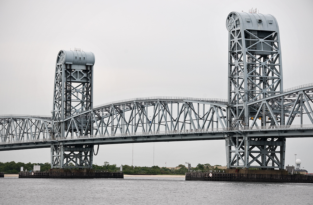
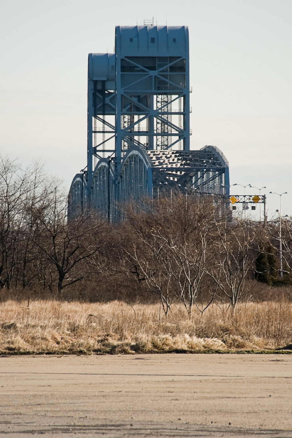
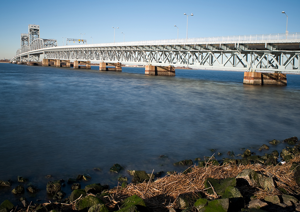
The Marine Parkway Bridge (also known as the Marine Parkway-Gil Hodges Memorial Bridge) is a vertical lift bridge which connects Flatbush Avenue at Floyd Bennett Field in Brooklyn with Jacob Riis Park and Fort Tilden in the Rockways in Queens.

Plans for a New Bridge: Robert Moses & The Marine Parkway Authority

Fiorello LaGuardia was narrowly elected Mayor of New York City in 1933; he would serve three terms from 1934 to 1945. LaGuardia was impressed by the parkways Robert Moses had built in Long Island (and by his ability to raise federal funds to finance them), and he immediately offered him a job in his administration. Moses had plans for parkways and parks in New York City ready to go, and he only agreed to take the job from LaGuardia if he would have control of the parks departments in all five boroughs, which had previously been independent of one another. Moses also wanted control of the parkways; LaGuardia agreed. Moses quickly took over the the Triborough Bridge Authority; that bridge’s construction had begun in 1929 but had stalled and remained incomplete. He also introduced a plan to finance construction of the Marine Parkway Bridge that called for the creation of the Marine Parkway Authority, of which, of course, Moses would be chairman and sole member. He raised money for these and other projects (which would charge tolls when they opened) by issuing bonds; when a project was complete, he would not sell off the bonds but would begin another toll-collecting project, continuing the cycle.

Opposition

Moses issued $6,000,000 in bonds in order to build the Marine Parkway Bridge, and it was expected that within 25 years, through toll collection the bridge would pay for the loan and allow the bridge to be self-sustaining. However, there was plenty of opposition to the bridge proposal. The surrounding communities had been served by ferries and many people did not want to see that change. There were others who felt that Jamaica Bay might one day become a major port and the building of a bridge would destroy that potential. So, more than $18 million was spent by the U.S. War Department to dredge Rockaway Inlet and the bridge was designed to be a lift span, to enable the channel to remain clear for ship traffic. There was also the issue of ice: it was feared that ice would pile up on the bridge piers and either block passage or cause the surrounding areas to flood, sweeping cottages along Rockaway Beach out to sea. The solution was to bring in a forest of 600-foot-tall Douglas fir trees from the west coast to be driven into the sand and act as fenders against the ice around the bridge’s piers.

Marine Parkway Bridge, seen from Floyd Bennett Field

The Barren Island Squatters

Another problem encountered before construction of the bridge could begin was a well-established colony of squatters living on what formerly was known as Barren Island. Barren Island was a roughly three mile long and one mile wide stretch in the southern Brooklyn section of Jamaica Bay. In the late 1800s, the land at either end of the island the island was home to several putrid-smelling industries including fish, fat, and offal rendering plants and another that rendered horse bones into glue, leading to the the body of water on the island’s western shore’s name: Dead Horse Bay. About 120 acres in the center of the island was owned by the city, intended to be used as a dumping ground. However, due to the city’s neglect, the land was taken over by a colony of squatters, who by 1877 numbered around 100. The squatters kept livestock such as goats and pigs, and even set up a liquor saloon on the island. The stench of the rendering plants grew worse and worse, and after years of complaints from Brooklyn residents, the plants were required to dump their refuse at sea. The Brooklyn Daily Eagle described the situation in 1899 as being “improved:”

Nowadays the ancient cheeses, the butchers’ offal, the long-deceased animals, the contents of refuse cans and barrels are not piled along the waterfront… On the contrary, the process is quick and thorough. Deodorizing substances are freely used in the materials that are disgorged from New York’s thousands of kitchens and butcher shops. The sufferings that are reported in various parts of Brooklyn and along the south shore probably result in larger measure than the people realize from the dumping which is still carried on at sea, the scows going out six or eight miles, instead of the required forty, and throwing overboard tons of swill that the incoming tide washes upon the shored of Coney Island, Rockaway and even Long Beach. This vile stuff festers in the sun, sours and breeds maggots and flies by millions. [1]

Despite many attempts over the years to remove the squatters, they stayed put. Barren Island was connected to the Brooklyn mainland with landfill during the construction of Floyd Bennett Field (New York City’s first municipal airport), which opened in 1931. By then the rendering plants were long gone, but the squatters still remained. In 1936, Robert Moses, as Park Commissioner, called for their eviction; at that time there were an estimated 90 squatters (and their livestock) still living on the former island. They were given until April 15, 1936 to vacate, and Alderman Joseph B. Whitty of Brooklyn was granted a promise by Mayor LaGuardia that the houses on the island would be treated as “condemned tenements” [2], so that the squatters would be provided with free moving service as they left the island. In August of the same year, five acres of marijuana plants were discovered on the island, upon which the goats the squatters had kept had been grazing. The squatters, when questioned, denied that there was any other intended use for the plants.

Engineering

Moses the planner had engineers ready to work on the Marine Parkway Bridge. The chief engineer on the project was Rensselaer Polytechnic Institute graduate Emil H. Praeger (who worked on numerous projects for the Parks system and went on to design the Tappan Zee Bridge). The firm of Madigan-Hyland were also involved as engineers. Robinson & Steinman were hired as consultants; Holton D. Robinson was the engineer of the Williamsburg Bridge and David Steinman designed the Henry Hudson Bridge as his thesis while at Columbia University. The title of Engineering Designer was filled by the esteemed Waddell & Hardesty, formed in 1927. Also both Rensselaer graduates, the firm of J.A.L. Waddell and Shortridge Hardesty was known for its movable bridge designs, especially vertical lift spans. The contractors awarded the bids for construction of the bridge were the Frederic Snare Corporation and the American Bridge Company.

Construction & Design

Construction began on June 1, 1936. A method differing from usual lift bridge construction was used, where instead of floating the lift span in at the very end, it was placed partway through, planned to coincide with a particularly high tide. Just after midnight on January 12, 1937, 38 workmen from the American Bridge Company began the operation; tugboats guided the central span along and at 7:45 a.m., while the tide was at its highest, it was placed into position. The partially built towers had a special trestle attached to their foundations from which the towers would be completed.

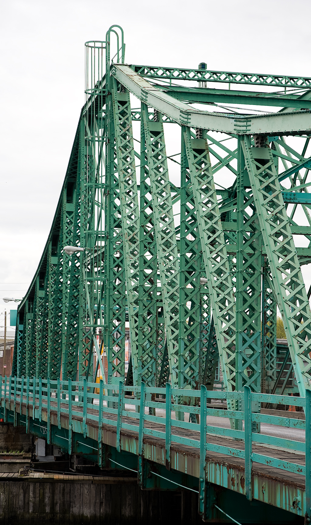
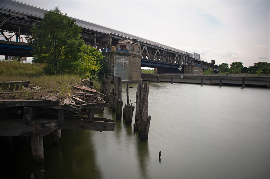
The bridge is designed of three main 540-foot spans, each allowing for a 500-foot clear channel. There are two 1,061-foot approaches; its total length is 4,022 feet, 6 inches. The 2,000-ton central span could be raised from 50 feet to a total clearance of 150 feet above the high water mark in two minutes. When it was completed it was the longest highway lift bridge in the world (it is still the longest of its type in North America), built of 12,000 tons of steel and 47,000 cubic yards of concrete. The bridge was painted olive green with silver trim. The roadway, instead of being solid, was built of steel plates, similar to subway gratings set in sidewalks throughout the city. It was the first roadway of this type to be used on a bridge on the East Coast. The open grates were also painted green.

One complaint about vertical lift bridges at the time was that their appearance could be ugly; often they were employed by railroads and were decidedly utilitarian in design. In response to this, the towers of the Marine Parkway Bridge were tapered and a pattern designed to hint at the great wheels that lifted the bridge rather than hiding them [3]. Construction was finished less than a year after it began, and the bridge was scheduled to open in July, in time for motorists to enjoy the summer in the new Jacob Riis Park.

Marine Parkway Bridge from Rockaway

Opening Ceremony

The bridge officially opened on July 3, 1937. The ceremony was headed by Mayor LaGuardia who was joined by Park Commissioner Robert Moses and various other city officials. 500 cars full of invited guests waited on the Brooklyn side of the bridge, on the approach built on Barren Island. Guns were fired from Fort Tilden, fireboats sprayed water into the air, and nine Martin planes flew in formation overhead. The center span was lowered for traffic and at 10:30 a.m. a parade of cars began to cross the bridge to Jacob Riis Park, where Moses gave a speech detailing the planning that had led up to the building of the bridge. It was given recognition in the engineering world as well: The National Steel Bridge Alliance awarded it first place in the movable bridge category in 1937.

Renaming & Rehabilitation

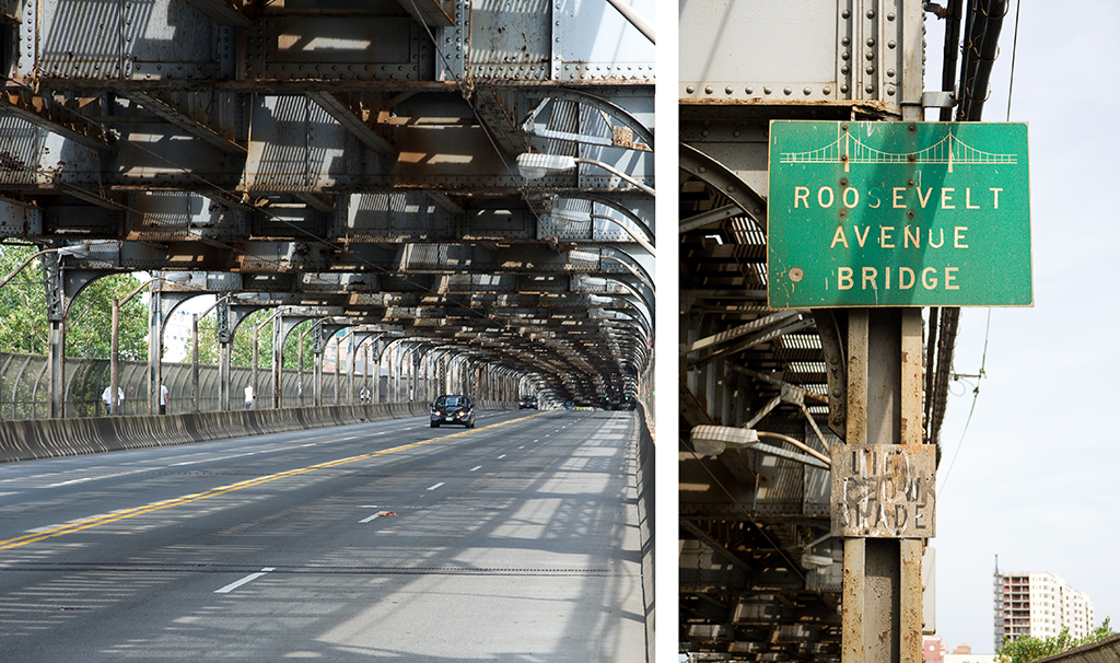
The bridge was renamed in 1978 in honor of Gil Hodges, a former Brooklyn Dodgers first baseman, though the name has not taken into common usage [4]. The Marine Parkway Authority was absorbed into the larger Triborough Bridge Authority in 1940 (becoming he Triborough Bridge and Tunnel Authority in 1946). Traffic and toll collection on the Marine Parkway Bridge did not turn out to be enough to pay for its own expenses, but other bridges and tunnels run by the TBTA were profitable enough to carry those that were less so. The TBTA is now under the jurisdiction of the MTA, who began a major rehabilitation project on the bridge in 1998. The steel deck was replaced with concrete and steel, a “Jersey” barrier was added to separate traffic, electrical systems and traffic control were updated, and new signs were put in place. The $120 million project was finished in 2004; the bridge still opens more than 100 times a year.

[ continue to references ]

Hunters Point Avenue Bridge

Hunters Point Avenue Bridge

Location: Hunters Point Avenue over Dutch Kills, Queens, NY [satellite map]
Carries: 2 vehicular lanes, 2 pedestrian sidewalks
Design: bascule
Date opened: December 14, 1910

The Hunters Point Avenue Bridge carries the street bearing its name across Dutch Kills, a tributary of Newtown Creek, in Long Island City, Queens.

The Need for Movable Bridges

The section of Queens now known as Long Island City was originally low-lying marshland dotted with small towns. In 1861 the Long Island Railroad arrived after relocating its main terminal from Atlantic Avenue in Brooklyn to Hunters Point in Queens (a ferry leaving 34th Street carried passengers across the East River to Hunters Point). With the area rapidly industrializing, in 1869 Hunters Point pushed to to be incorporated into a larger, more important entity, combining with Ravenswood and Astoria. Thus, in 1870 Long Island City was born. Industry boomed, and gas and chemical plants along with various other types of factories took over much of the marshland. Of course, no regulations existed at the time to dissuade the dumping of toxic by-products into the waterways, and Newtown Creek and Dutch Kills both suffered sorely from this industrial pollution. Both rivers were heavily used and required bridges that allowed the waterways to remain navigable, so a large concentration of movable bridges is seen in the area.

The Iron Bridge
The Iron Bridge, 1867-1907 (Source: Historical Facts in Connection with New York City Bridges)

Previous Bridges

Prior to 1874, Dutch Kills was crossed at Hunters Point Avenue by a wooden bridge. With so much industry moving in to the area, it was soon inadequate and was replaced in 1874 by an iron drawbridge. The iron drawbridge was problematic, and frequently had to be put out of service to be repaired. The bridge was poorly maintained and it was obvious something had to be done to keep navigation on Dutch Kills open. In 1906, Bridge Commissioner James W. Stevenson wrote to Queens Borough President Joseph Bermel requesting that since the bridge was over navigable water it ought be operated by the Department of Bridges. Bermel agreed, and on January 25, 1906, the bridge was put under the jurisdiction of the Department of Bridges, having just been put back into working order by the Department of Highways. By March 1907, it was found that the west abutment had been pushed forward by the ever-shifting marshland and the bridge could no longer close. The iron bridge was closed to traffic permanently and the Department of Bridges began planning for its replacement.

The Scherzer Rolling Lift Bridge
The Scherzer Rolling Lift Bridge, 1910-1983 (Source: Historical Facts in Connection with New York City Bridges)

The Scherzer Rolling Lift Bridge

The design approved by the Art Commission on April 13, 1909 was for a double-leaf Scherzer Rolling Lift bascule bridge. Bids were received in July; the North-Eastern Construction Company was the lowest at $95,214.11 and was given the contract to build the bridge. Construction began on July 13, 1909 and the bridge opened to traffic on December 14, 1910. The final cost was $102.985.56, about $8000 over the bid but still under the $110,000 budget allotted to it by the Department of Bridges.

Rebuilding

By the 1970s, following decades of neglect, many of New York City’s bridges were in need of major rehabilitation. The Department of Transportation released its first-ever survey of bridge conditions in 1978 and the Hunters Point Avenue Bridge was included on the “poor” list. This was for good reason: the previous year it had been closed entirely because parts of it had rotted away, rendering it unsafe for traffic. It was repaired just enough to handle cars, but a major rehabilitation was needed. In 1983 it was rebuilt as a single-leaf bascule bridge with a span of 21.8 meters, using the foundations of the Scherzer bridge. It celebrated its 100th birthday in December 2010, which was marked by a walking tour hosted by the New York City Bridge Centennial Commission and the Newtown Creek Alliance.

bridge house
bridge house

[ continue to references ]

Grand Street Bridge

Grand Street Bridge
Grand Street Bridge

Crosses: Newtown Creek
Connects: Grand Street, Williamsburg, Brooklyn and Grand Avenue, Maspeth, Queens, NY [satellite map]
Carries: 2 vehicular lanes, 2 pedestrian sidewalks
Design: swing bridge
Date opened: February 5, 1903

The Grand Street Bridge is a through truss swing bridge across Newtown Creek, connecting Maspeth, Queens with Williamsburg, Brooklyn.

Earlier Bridges

In the 1850s Newtown Creek was an incredibly busy and polluted waterway, crowded with ships serving industrial sites like the glue factories, smelting plants, and refineries that lined its shores.

Grand Street Bridge, circa 1920 (Source: Historical Facts in Connection with New York City Bridges)

The first bridge to carry Grand Street over Newtown Creek was authorized to be built in 1869, with the cost of construction to be split between the town of Newtown (now a part of present day Queens) and the city of Brooklyn. A contract was awarded in 1874 to the King Iron Bridge & Manufacturing Company of Cleveland, Ohio, and an iron swing bridge was completed at the site the following year. In 1878, the Kings County Board of Supervisors reported that the bridge was already in bad shape; the swing span had become difficult to turn, causing traffic delays to become a commonplace occurrence. By 1881 the bridge had sunk so far into the mud that at high tide the turntable would become partially submerged in the creek. The Joint Committee on Bridges called for its replacement in 1888. A new iron swing bridge with masonry piers opened the following year. Jurisdiction over the bridge was given to the Department of Bridges in 1898 following the consolidation of the five boroughs into the City of New York. In 1899, the US War Department, looking to dredge and widen Newtown Creek, found the bridge to be an obstruction to navigation and ordered yet another bridge to be built on the site.

bridge house
bridge house

plaque
plaque

Current Bridge

On June 11, 1900, Department of Bridges Commissioner John L. Shea advertised for bids on the construction of a new span. On August 7, a contract was awarded to Bernard Rolf for a steel swing bridge at a cost of $173,380. The old bridge was closed on August 27 and a temporary pedestrian bridge made of wood was built. Construction of the new bridge took much longer than initially expected. Labor strikes, poorly made engineering plans, and deliveries of low quality building materials were compounded by problems with the dredging of the creek. The situation improved when prominent bridge engineer Gustav Lindenthal was appointed Bridge Commissioner by Mayor Seth Low in 1902. In November of that year, consulting engineer C.C. Martin was placed in full charge of the project by the Department of Bridges, and construction progressed quickly. The bridge was completed at a cost of $205,672 and opened to traffic on December 12, 1902. The City of New York officially accepted the bridge on February 5, 1903.

Crimes & Accidents

The Grand Street Bridge and the area very close to it on Newtown Creek have been site to numerous crimes and some mysterious drownings. The bridge was left unguarded at night: policemen stationed there left at 8pm and did not return until 4am. In November of 1894 The New York Times detailed a story told to them by George Roeschman, who said he had been approached by three men asking for a match while crossing the bridge one night. When he reached into his pocket, the men grabbed him, put a bag over his head, robbed him of all he had ($10), and tossed him into Newtown Creek. He lived to tell his tale, though his credibility is questionable: the lumber company Roeschman claimed he worked for had no idea who he was. In the same year several other bodies were pulled from the water near the bridge, it being unknown whether they were murdered or drowned. Two men were arrested and sentenced to Sing Sing Prison for taking and burying alive a baby from a Polish woman (of no relation to either) near the bridge.

In January 1896, Polish priest Reverend Leonard Syczek was heard crying out for help from the water by a watchman and two boat captains who happened to be nearby. He was pulled out but died later. It was thought he had fallen in accidentally: the entryways to the bridge were dark at night and it was easy to miss the walkway and fall right into the river. In September of 1927 a Maspeth man drove through the guardrail and off the narrow bridge after colliding with another car. He managed to free himself from his car and was rescued by boat.

Decline

The bridge held up relatively well until the 1950s, when reports of closures became frequent. Between 1952 and 1956 the main shaft on the turntable broke at least three times, each instance requiring a full day’s work for repairs, during which time the bridge was left in the open position to accommodate boat traffic. On June 12, 1975, a proposal was put into place to cut service for bridge openings. Until that time, a tender was employed 24 hours a day on the bridge. The plans were put off for a time, but were eventually put into place. In 2002, the Department of Transportation, who now has jurisdiction over the bridge, proposed turning the bridge into a fixed span, citing the decline of boat traffic that had come to obviate the need for bridge openings. The proposal has yet to be put into place, though bridge openings have become very rare. In 1998 (the most recent year for which data is available), the bridge was opened only 23 times for boat traffic, and another 63 times for testing. Those numbers show a sharp decline from as recent as 1990, when it was opened 610 times for boat traffic, and 42 times for testing.

009GrandStreet02
View from the canal
009GrandStreet03
swing span

[ continue to references ]

Roosevelt Avenue Bridge

Roosevelt Avenue Bridge

Crosses: Flushing River
Connects: Corona and Flushing, Queens, NY [satellite map]
Carries: 4 vehicular lanes, 2 sidewalks, IRT 7 subway
Design: double-leaf bascule
Date opened: May 14, 1927

The Roosevelt Avenue Bridge is a double-deck, double-leaf bascule movable bridge over the Flushing River in northeastern Queens. It carries four lanes of Roosevelt Avenue and two sidewalks on its lower deck, and three tracks of the IRT Flushing / 7 train line of the New York City Subway on its top.

Planning

Surveying for the bridge began in 1913 as part of an extension of the Interborough Rapid Transit Company’s Woodside and Corona line. The original plan had the line mapped out between 42nd Street in Manhattan and Prime Street in Corona, with the extension reaching out to the village of Flushing, with a possible further extension to Little Neck at the city line. The line reached Corona in 1917, but United States involvement in World War I prevented further construction. Financial problems after the war delayed progress still until 1921, when city engineers began negotiations with the US War Department concerning what type of structure the city could build to cross the Flushing River. The War Department, which had jurisdiction over all navigable waterways and their crossings in the country at that time, denied a request by the city to be allowed to build a simple fixed bridge across the river on account of it being an obstruction to river traffic. A tunnel was briefly considered, but was decided against when cost estimates for it reached $2,500,000, more than the city was willing to pay. The War Department suggested the city build a bascule bridge, and officials relented.

Construction

Groundbreaking for the bridge was held on April 21, 1923 in a ceremony attended by Mayor John Hylan and Maurice E. Connolly, Borough President of Queens. Construction began soon after, though many delays occurred due to a recurring problem with the foundations of the bridge settling in the deep mud on the banks of the river. On May 14, 1927, the bridge was opened to pedestrians and a bus line was established between downtown Flushing and Willet’s Point Boulevard station, the temporary terminal of the line while the foundation issues were being resolved. Train service would not begin across the bridge until January 21, 1928, with a special train for city officials making the inaugural run from Time Square to the new station in Flushing. The extension to Little Neck has yet to be built.

view from the walkway
Roadway and sign

The final cost of the bridge was $2,640,000, more than the estimated cost of a tunnel under the river, even when adjusted for inflation. Despite the additional cost the city was required to pay for a movable bridge, the need to keep the river open to navigation did not last long. When construction of Flushing Meadows Park was under way in 1939, park engineers realized a dam was needed to keep the tides of the East River from inundating the low-lying fields. The Long Island Railroad, which runs just a few hundred feet upriver from Roosevelt Avenue, agreed to replace the swing bridge they owned over the river with a combined embankment and tidal gate on top of which they would continue to operate their trains. With no docking facilities in place between the two structures, navigation of the Flushing River effectively ended at the Roosevelt Avenue bridge. In 1961, construction of the northern extension of the Van Wyck Expressway began, and the route of the highway was driven directly through the navigation channel of the bridge, supported over the river by concrete piers. The operating mechanisms and bridge tender’s controls were finally removed at that point, and the bridge has not opened since.

Design

The Roosevelt Avenue bridge was the largest trunnion bascule bridge in the world when it was completed. It was designed by Edward A. Byrne and Robert E. Hawley of the NYC Department of Plants and Structures, and built by the Arthur McMullen Company of New York. The channel of the river at the point of the bridge is only 70 feet wide, but because of the skew of the route over the river, the clearance between the bridge piers is 162 feet. Together, the lift leaves are 153 feet long, and each weighs approximately 4 million pounds, supported by a truss structure 25 feet 6 inches deep. The piers that support the leaves are of poured concrete construction, with granite blocks covering the facings exposed to the water. Each pier measures 92 feet by 118 feet, and contains a large hollow space inside to accommodate the movement of the bridge’s counterweights.

Future

In January, 2010, the NYC Department of Transportation announced plans to rehabilitate the bridge starting in 2012. Years of neglect have resulted in a need to replace the road deck, repaint and repair rust on the steel truss and approach structures, and repair deteriorating concrete. The city also plans widen the sidewalks from 8 to 10 feet and establish bike lanes within them. The project is expected to be finished in 2015.

Update (04/29/2015): Rehabilitation has been delayed and is now expected to begin in mid-2015 with an end date to be determined.

[ continue to references ]